|

France : Corse
4.1 km (2.5 miles) W of Bastelica, Corse-du-Sud, Corse, France
Approx. altitude: 946 m
(3103 ft)
([?] maps: Google MapQuest OpenStreetMap ConfluenceNavigator)
Antipode: 42°S 171°W
Accuracy: 2 m (6 ft)
Quality: good
Click on any of the images for the full-sized picture.


| 42°N 9°E (visit #2) |
![Visit #3: [03-Aug-14]](/fr/all/n42e009v3/preview.jpg "Visit #3: [03-Aug-14]")
![Visit #1: [09-Jun-02]](/fr/all/n42e009/preview.jpg "Visit #1: [09-Jun-02]")

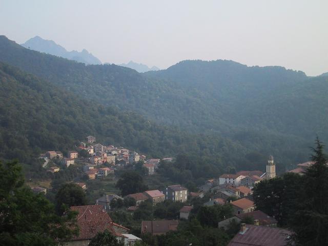
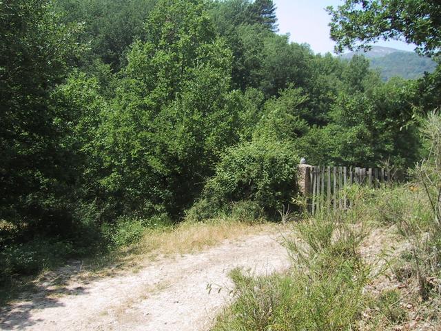
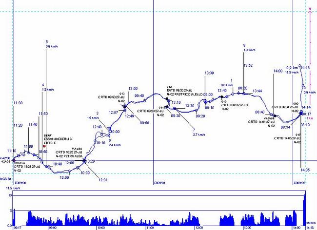
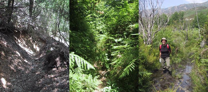
(visited by Michel Dupuis and Anne Marie Dupuis) 27-Jun-2002 -- 42N 009E, last but not the least of the french confluences to be visited, is in a remote aerea of Corsica on the municipality of Bastelica (and not Cannelle as improperly shown on the site). We knew it had been unsuccessfully attempted in the first days of june, and we were quite worried of the trek we were going to have. Technical bases for us were two nights in a small hotel in Bastelica (view from the dining room, picture 10), a conventional rented car, boots and walking shoes, garden gloves and secateurs, gps and compass, already worn out clothes, and the best possible map. The map was IGN TOP25 4252OT in 1/25000 scale, and we considered studying it that the only possible way, even if not the shorter, was to leave Bastelica north, by car, with the D27, and then try the small dirt road over "pont de l'Alzifella" to Pulasca and Tassiccia. The end of the track for cars is at Pulasca (42N 00.226 009E 01.870) (picture 2, and point shown as V42N9E on the recorded track), where the road ends abruptly, but shows a small path on the left. This small path, hunter path without any indications, is shown on the map, and brings you eventually to the confluence, up and down and winding over Vadina Bianca and the pass of Petra Alba. It is essential to have a very careful and close navigation, which needs the GPS to be used in UTM coordinates, to remain on the track. The path is often quite difficult : rolling stones under your feet, fern or brambles in your eyes, 3 brooks to cross, and a lot of mud and water at the end of the way close to the point. (picture 3, showing the first, second, and third portions left to right) There is no real track to the confluence itself and you need to use some low boar "under fern" paths" to get access keeping direction with the compass (picture 4). The IGN map is of the utmost importance as it is really quite close of what you find on the ground, and it's really impossible to go straight through the maquis or the forest. We needed 3 hours for 4.6 kilometers to get to the spot, (picture 1 showing the arrival, pictures 5 and 6 the views looking south-east and north-east, and picture 7 showing me on the spot itself). You leave the car at an elevation of 726 meters and climb to the pass at 986 meters, while the confluence itself is 957 meters high (see gps reading picture 8) (and not 875 as shown on the site). 3 extra hours were necessary to come back the same way (picture 9 shows the recorded track) , and an afternoon nap followed as the temperature had been between 25 and 30 degrees (77 to 86°F)! Anyway this is a very nice and interesting walk which needs to be recommended as it offers broad views on the corsican mountains in a nearly unspoiled nature. |
| All pictures |
| #1: View west arriving to the confluence #2: Starting point of the walk #3: the path, first, second, and third thirds #4: in the boar paths for the last meters #5: view south east from the spot #6: view north east from the spot #7: Me on the spot #8: the GPS #9: the recorded track #10: Bastelica village ALL: All pictures on one page |