|

France : Normandie
2.2 km (1.4 miles) NNW of Saint-Louet-sur-Vire, Manche, Normandie, France
Approx. altitude: 103 m
(337 ft)
([?] maps: Google MapQuest OpenStreetMap ConfluenceNavigator)
Antipode: 49°S 179°E
Accuracy: 5 m (16 ft)
Quality: good
Click on any of the images for the full-sized picture.


| 49°N 1°W (visit #2) |
![Visit #9: [25-May-22]](/fr/all/n49w001v9/preview.jpg "Visit #9: [25-May-22]")
![Visit #8: [17-Aug-18]](/fr/all/n49w001v8/preview.jpg "Visit #8: [17-Aug-18]")
![Visit #7: [01-Jan-15]](/fr/all/n49w001v7/preview.jpg "Visit #7: [01-Jan-15]")
![Visit #6: [17-Aug-13]](/fr/all/n49w001v6/preview.jpg "Visit #6: [17-Aug-13]")
![Visit #5: [17-Jun-10]](/fr/all/n49w001v5/preview.jpg "Visit #5: [17-Jun-10]")
![Visit #4: [05-Jun-10]](/fr/all/n49w001v4/preview.jpg "Visit #4: [05-Jun-10]")
![Visit #3: [06-May-09]](/fr/all/n49w001v3/preview.jpg "Visit #3: [06-May-09]")
![Visit #1: [01-Sep-01]](/fr/all/n49w001/preview.jpg "Visit #1: [01-Sep-01]")

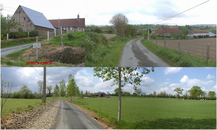
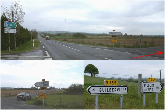
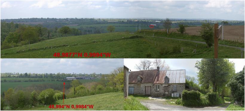
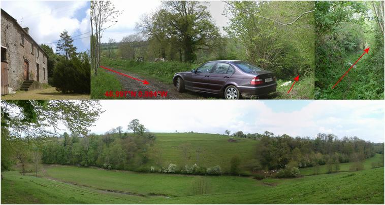
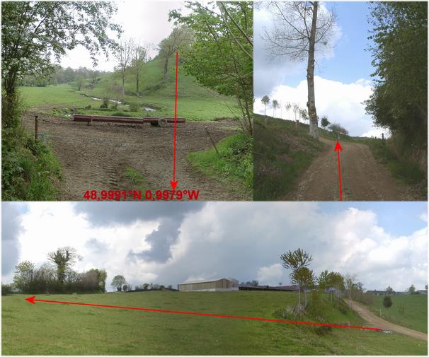
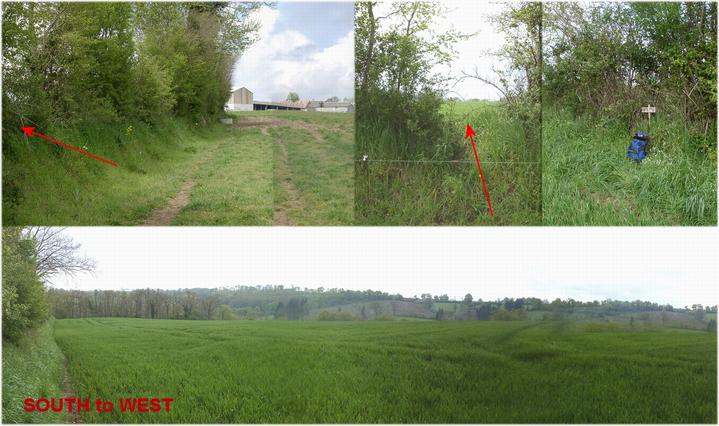
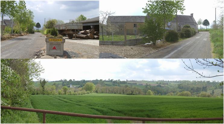
(visited by Hans Augdoppler) 04-May-2002 -- Unsatisfactory map material and the report of visitor#1 lured me to access this confluence from the south. I left the A84 at EXIT40 and drove on the N174 NNW and turned after about 2.7 km direction the west into secondary road D159. Through hilly landscape (SW) I continued to the junction (48.9877° N 0.9994° W) further to the north into the access road. From there you may see the CP already (I didn't know this when approaching). This road ended at two farmhouses (distance ~500 m). Onto a narrow track across the fields I drove on in the direction NW (48.997° N 0.994° W). From there led me overgrown path into the valley towards north. The first obstacle was an armoured electrical fence, then over a marshy pasture, a brook (48.9991° N 0.994° W), again an electrical fence (active) and finally a good gravel road uphill. With a view to the back of a farmstead I crossed a meadow towards the WEST facing the CP. Again there was an electrical fence, through the hedge and then a cornfield with the CP along the hedge. A look to the south on the opposite slope of the valley shows me the starting point of my walk aim. On the way back to the car I decided to have a look for a more pleasant access route. After quite a number of wanderings I finally found a junction with signpost 'La Milanderie' and 'La Rogerie' (49.002° N 0.989° W) on the D451. The road ran westward through pastures and meadows. I passed 'La Rogerie' and then a gate at the back of 'La Milanderie' with a direct look on the CP. It is only about 130 m and no electrical fence at all. For more information see: http://linz.orf.at/gast/augdoppl/Confluence/Main.htm |
| All pictures |
| #1: Confluence area from SOUTH #2: Access from N174 -> D159 #3: Farm road with view at CP area & farmhouse #4: Starting point & valley #5: Access via gravel road and pasture #6: Access through hedge, the CP and view to SOUTH #7: Map with GPS reading #8: Access via farm from EAST #9: Backyard of farm with alternate access ALL: All pictures on one page |