|

Slovakia
1.9 km (1.2 miles) N of Chminianske Jakubovany, Prešovský, Slovakia
Approx. altitude: 539 m
(1768 ft)
([?] maps: Google MapQuest OpenStreetMap ConfluenceNavigator)
Antipode: 49°S 159°W
Accuracy: 15 m (49 ft)
Quality: good
Click on any of the images for the full-sized picture.
; EAST (bott.)")
 and its hinterland (NORTH)")


")
| 49°N 21°E (visit #2) |
![Visit #5: [28-Sep-22]](/sk/all/n49e021v5/preview.jpg "Visit #5: [28-Sep-22]")
![Visit #4: [03-Sep-11]](/sk/all/n49e021v4/preview.jpg "Visit #4: [03-Sep-11]")
![Visit #3: [19-Oct-07]](/sk/all/n49e021v3/preview.jpg "Visit #3: [19-Oct-07]")
![Visit #1: [20-Jan-02]](/sk/all/n49e021/preview.jpg "Visit #1: [20-Jan-02]")

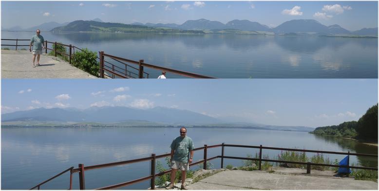
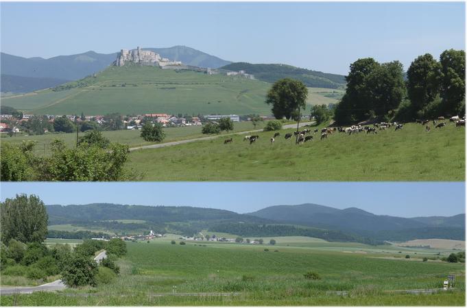
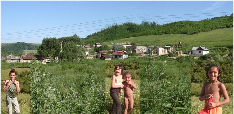
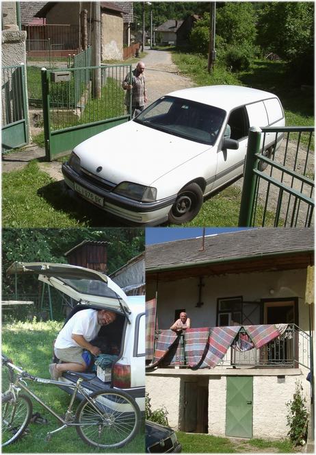
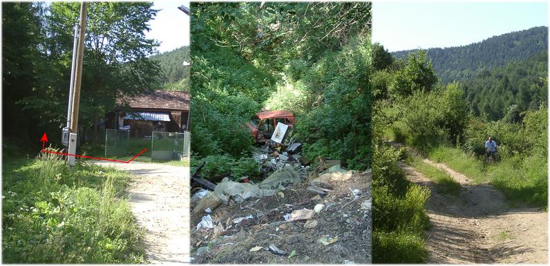
(visited by Hans Augdoppler and Klaus Baumgartner) 20-Jun-2002 -- This CP stands for gypsies and horse flies. On our way to the east of Slovakia we passed the Liptovská Mara lake (Liptov region), the beautiful city of Levoča (Leutschau) in the ‚Zipser Land’ (Spiš) and paid a visit to the mighty Spišský Hrad (‚Zipser Burg’) (also American tourists had gone astray here). Like László & Krisztina we went to Prešov via Fričovce. In accordance to our maps the entrance via Chminianske Jakubovany seemed more promising to us. We passed Chminianska Nová Ves and drove WSW in the direction of the starting point. We passed a gypsy village along the road and with some doubt we finally reached a little farmstead. From there the indicated creek and the forest path in direction NNW started. We asked for permission to leave the car just outside the fence. With reference to the theft danger the friendly farmer invited us to park the car within his courtyard. After we had reassembled our bicycles, we pedalled hard up the forest path. We noticed that the CP must lie in the area of the relatively steep, wooded southern slope. We drove on till we reached approximately the height of the point along the slope. Then we started to walk finally along the contour line. Already after some minutes our presence had got round and we were swarmed round by stable flies. Only quick movements could slow down the attacks so that we finally reached the area of the CP extremely exhausted. Hampered by the dense tree and the regular attacks of the insects (also see) we had great trouble concentrating and identifying the location of the CP. When we returned to our bicycles our legs were scratched and bitten while our new Confluence T-shirts were sweaty. One shall never wear short trousers for such adventures. The way back to the valley was easy and we found a wild waste landfill. After we had thanked the farmer family and exchanged our local liquors, we left the area again passing gypsy children taking a bath. Right map in pic#8 © MapPoint Europe http://www.microsoft.com For more information see: http://linz.orf.at/gast/augdoppl/Confluence/Main.htm |
| All pictures |
| #1: Confluence area from the SOUTH #2: Liptovská Mara artificial lake – to WEST (top); EAST (bott.) #3: Spišský Hrad (top) and its hinterland (NORTH) #4: Gipsy village along the road to Chminianske Jakubovany #5: Base at small farm in Chminianske Jakubovany #6: Confluence from WEST & Hans laughing while tortured by horseflies #7: Walking into the forest, CP & Klaus and Hans with Confluence T-shirts #8: GPS readings & maps #9: Route into forest from farm / garbage deposit / track towards CP #10: Panoramas from Spiš Castle (Zipser Burg) ALL: All pictures on one page |