|

Morocco
38.9 km (24.2 miles) WSW of Cap Blanc du Nord, Casablanca-Settat, Morocco
Approx. altitude: 0 m
(0 ft)
([?] maps: Google MapQuest OpenStreetMap ConfluenceNavigator)
Antipode: 33°S 171°E
Accuracy: 40 m (131 ft)
Quality: good
Click on any of the images for the full-sized picture.


| 33°N 9°W |

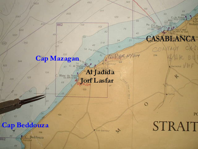
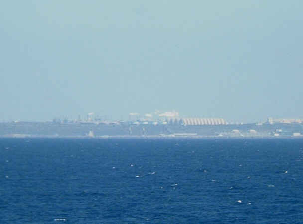
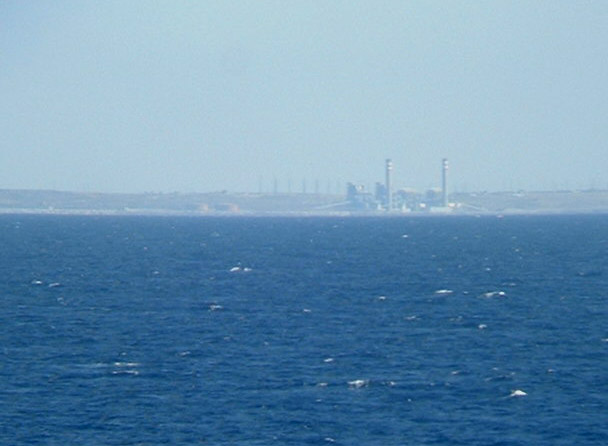
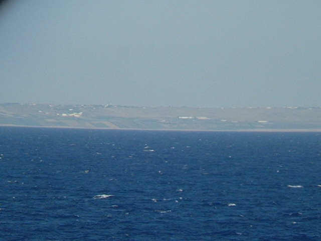
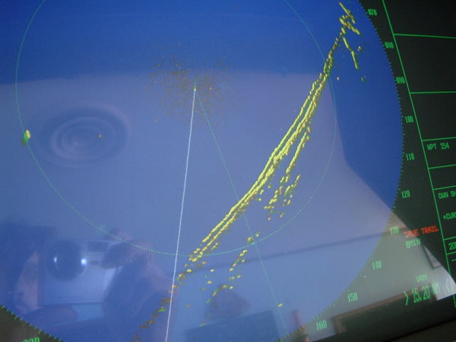
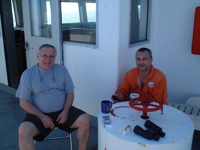
(visited by Captain Peter, Valentyn Smirnov, Volodymyr Kokorev and Volodymyr Sydorenko) 12-May-2002 -- 12 hours prior to our arrival at Agadir we visited 33°N 9°W. The point lies SW of the town of al-Jadīda between Cap Blanc du Nord and Cap Beddouza. al-Jadīda consists of an old part, in the East, and to the West there is the new town. The total population of both parts is about 60,000. South of al-Jadīda there is the modern port of Jorf Lasfar. It was completed around 1980. Phosphates and other minerals are exported from there, and ships up to 120,000 tons deadweight can be accommodated. The coast between Cap Mazagan and Cap Beddouza, which can be best seen from the Confluence, is mostly rocky and backed by sand dunes. Behind these dunes are cliffs laying parallel to the coast. This is very well observed in the radar. The Kingdom of Morocco occupies the NW corner of Africa. The earliest peoples to explore Morocco were the Phoenicians and the Carthaginians, who established trading stations on its coast. The Romans followed, but their sway never extended beyond the North part, and on the fall of the Roman Empire, the civilization and language of Rome died out. Little more is known of Morocco prior to the great wave of Arab conquest in the seventh century. This swept over the country leaving the Arabs in possession of the towns and plains while the Berbers, the original inhabitants, survived in the mountain regions retaining their own language and customs, although they were converted to Islam. The Atlantic coast of Morocco was explored by the Portuguese in the fifteenth century, but they made no settlement. From the Arab conquest to the beginning of the twentieth century, Morocco was ruled by a series of Arab dynasties, none of which lasted for long or had a very firm grip on the country. During the nineteenth century both France and Spain began to have territorial ambitions in Morocco, which were for a long time thwarted by Britain, who did not want to see a strong power established on the South side of the Strait of Gibraltar. With the "Entente Cordiale" in 1904, Britain withdrew her opposition and in 1912 France established a protectorate over the greater part of the country, while Spain established one over a much smaller area in the North. These protectorates continued, with many small wars and revolts, until 1956 when France and Spain made a joint declaration withdrawing their protectorates and the former Sultan assumed the title of King of Morocco. At the same time, the former international zone of Tangier became Moroccan territory. Today only two tiny Spanish exclaves still lay on the African continent: The towns of Ceuta and Melilla, on the Mediterranean coast. As it is Sunday, Chief Engineer Kokorev and Reefer Enigneer Kovalenko are enjoying the fine weather at the bridge wing. The necessary equipment for modern seamen is with them: Coffee, Cigarettes, binoculars and a mobile phone, which is working near the coast and serves to phone the beloved ones far away at home. ------------------------------------------ |
| All pictures |
| #1: Coast of Morocco #2: GPS #3: Map #4: Old part of al-Jadīda #5: New part of al-Jadīda #6: The modern port of Jorf Lasfar #7: The phosphoric acid plant at Jorf Lasfar #8: Cap Beddouza #9: The coastline and the parallel cliffs on the radar screen #10: Chief Engineer Kokorev and Reefer Engineer Kovalenko with their necessary equipment ALL: All pictures on one page |
| Notes |
|
In the ocean, but with a view of land. |