|

South Africa : Eastern Cape
31.0 km (19.3 miles) W of Burgersdorp, Eastern Cape, South Africa
Approx. altitude: 1418 m
(4652 ft)
([?] maps: Google MapQuest OpenStreetMap ConfluenceNavigator)
Antipode: 31°N 154°W
Accuracy: 5 m (16 ft)
Quality: good
Click on any of the images for the full-sized picture.


| 31°S 26°E |

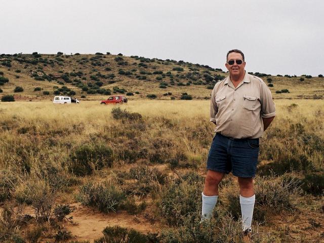
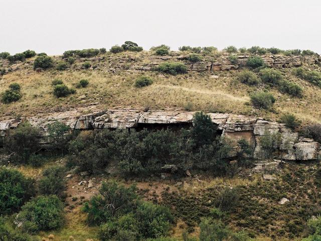
(visited by Peter Hers and Jocelyn Hers) 01-Mar-2002 -- On our recent trip down to the Eastern Cape we planned to visit as many Confluences as possible. On the first day we left late, and ran into some torrential downpours which made it impractical to stop for any Confluences. Our overnight stop was at a B&B near Venterstad, just south of the Gariep Dam. (See report on later visit to 30S 26E). So after a lovely breakfast we set off for the first real Confluence visit of our trip. The map showed it to be almost on a "road", but the road was indicated on the 1:250,000 map as a dashed line, which is indicated as "other road", i.e.: you take your chances! The nice thing about these maps is that they show the location and names of the main farmsteads, although as the maps we were using were over 20 years old there was a good possibility of things having changed. We found the farmstead Tweefontein ("Two fountains"), and a farm gate which seemed to lead to the track we wanted. The farmstead was no longer occupied by a farmer, but there were a few farm labourer families living nearby. We asked a woman who was doing her washing about the track, and she seemed quite happy for us to use the road to get to the next farm. So off we went, up a very bumpy track, and passed through three gates before reaching the top of the rise. Here we could see we were about 8 km away from the confluence point, but then we came to a gate which was very definitely locked, with a brand new padlock. Well, we sat and discussed the situation, but it was clearly too far to walk to the Confluence. We took a photo and were preparing to return when we saw a vehicle following us along the track. Was this an angry farmer, ready to chase us off his land? But no, it turned out that he was the owner of the next farm, and had the key to the gate. We explained the Confluence Project to him and he was quite interested, and offered to take us right to the point, as he was going that way anyway. So what more could we say, and we set off following him through 7 more farm gates, and finally we were only about a 100 metres or so away, and he insisted on coming all the way with us. The photos show views in four directions from the confluence point, and then one of the actual confluence point with the owner of the farm, Jan van Straaten. The Confluence is in the Langkamp ("Long field") on the farm Cyprusdale, which has been in the Coetzee family for generations. On the way to the point we passed the unoccupied homestead of the farm Skilderkrans, named for an overhang which contained some bushman paintings. As the overhang was quite far from the track, and we still had far to travel we did not visit it. |
| All pictures |
| #1: View to the North #2: View to West #3: View to South #4: View to East #5: Owner of the farm Jan van Straaten at the confluence point #6: Skilderkrans - Overhang with bushman paintings ALL: All pictures on one page |