|

United Kingdom : Scotland
7.7 km (4.8 miles) SSE of Ruthven, Highland, Scotland, United Kingdom
Approx. altitude: 584 m
(1915 ft)
([?] maps: Google MapQuest OpenStreetMap ConfluenceNavigator)
Antipode: 57°S 176°E
Accuracy: 1.7 km (1.1 mi)
Quality: good
Click on any of the images for the full-sized picture.


| 57°N 4°W (visit #1) | (incomplete) |
![Visit #8: [22-Aug-20]](/uk/sc/n57w004v8/preview.jpg "Visit #8: [22-Aug-20]")
![Visit #7: [27-May-14]](/uk/sc/n57w004v7/preview.jpg "Visit #7: [27-May-14]")
![Visit #6: [26-Aug-06]](/uk/sc/n57w004v6/preview.jpg "Visit #6: [26-Aug-06]")
![Visit #4: [07-Sep-05]](/uk/sc/n57w004v4/preview.jpg "Visit #4: [07-Sep-05]")
![Visit #3: [22-Sep-04]](/uk/sc/n57w004v3/preview.jpg "Visit #3: [22-Sep-04]")
![Visit #2: [02-Mar-02]](/uk/sc/n57w004v2/preview.jpg "Visit #2: [02-Mar-02]")
![Visit #5: [15-Nov-04]](/uk/sc/n57w004v5/preview.jpg "Visit #5: [15-Nov-04]")
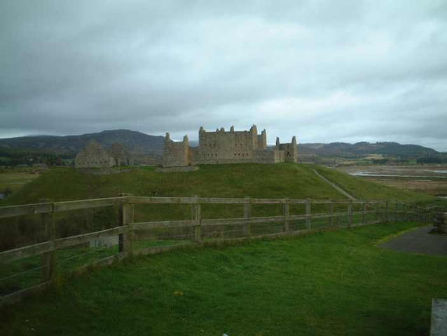
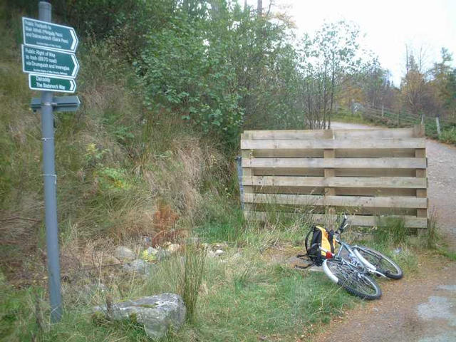
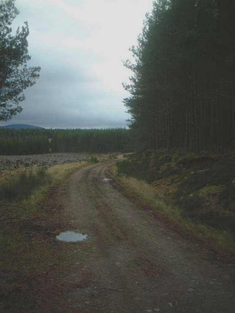
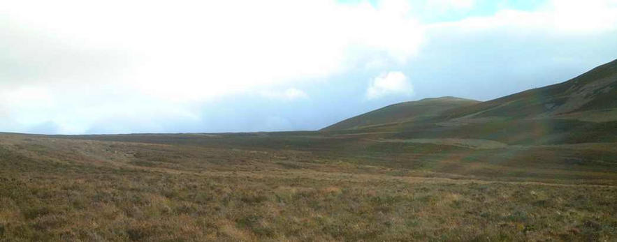
 (visited by kevin watt) 02-Nov-2001 -- First of all, I’ll admit, I didn’t make it! I attempted this confluence on my birthday last year and at the time didn’t feel justified in posting the details of my days efforts. I had tried, and I came within a mile or so of the confluence but didn’t think it met the required DCP site standards. But having seen some of the recently posted confluences and requests for confluences at sea I thought ‘why not?’ I set off that morning at 5:30am to catch an early train to Kingussie, the nearest town to the confluence. The journey was about 3 hours long and meandered through some of the most breathtaking Grampian scenery, the kind of thing that makes you want to paint your face blue with the white Saltire patriotically plastered across your nose (maybe just if your Scottish). As the train pulled in to Kingussie, the Monadhliath Mountains towering over to the West and the Cairngorms in the distance to the East, I started to comprehend the scale of this Confluence. From Kingussie I started cycling towards my intended route over the River Spey and past Ruthven Barracks. From the station it was a couple of miles to the start of the forest track which I hoped would lead me to within a mile or so East of the spot. I had chosen this approach as, from the OS map it looked as if the final mile would be a more gradual climb to the 580m elevation at 57N 4W. There was a track leading to the West of the Confluence but it would involve a steeper ascent over the last few miles. What was to be a straightforward cycle along a forest path turned out to be an expedition that would justify every penny I had spent on my eTrex. The tracks on the OS map were out of date and inadequate. The forest had changed over the years. It was like meeting up with an old friend, you can make out the main features, but a lot of new lines have been added! Without the GPS I would still be celebrating my next birthday in the Inshriach Forest. Despite finding my bearings, time was running out and things were looking bleak. It was becoming more of a challenge and the chances of making the round trip before 4:00pm, when it would be dark, were slim. The final straw was a fence that surrounded the forest. It didn’t look like I would be welcomed as a cyclist if I climbed over into the neighbouring hills. I turned for home. As the return journey through the forest was much quicker than the original trek, I found myself with some time on my hands. So I decided to follow the road that led to the approach from the West. The flat farm road which followed the River Tromie meant that I was within a couple of miles of the Confluence in a fraction of the time it had taken me to cover the same distance on the East side. I left the bike and started the climb towards my goal. It had been raining heavily the week before and my cycling boots were not designed for the sodden peaty hills by Glen Tromie. It took me a further 45 mins to climb the steep first mile. I had climbed to about 500m and 57N 4W was only another mile over a relatively flat section of land between Meallach Bheag and Clach-mheall (no, I don’t know how to pronounce it either) but it was getting late and I couldn’t take the risk of being lost in the dark or more importantly missing my train home. I took some pictures and readings and made my way back to the bike. I won’t deny that I was upset at having come so close and not succeeding, but it was one of the best birthdays I’ve ever had! And yes, I will try again. |
| All pictures |
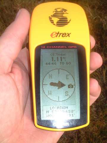
| #1: 57N 4W on the horizon #2: The GPS reading #3: The start of the Inshriach Forest route #4: Ruthven Barracks #5: The track through Inshriach Forest #6: The road through Glen Tromie ALL: All pictures on one page |