|

South Africa : North West
10.8 km (6.7 miles) SSW of Derby, North West, South Africa
Approx. altitude: 1623 m
(5324 ft)
([?] maps: Google MapQuest OpenStreetMap ConfluenceNavigator)
Antipode: 26°N 153°W
Accuracy: 3 m (9 ft)
Quality: good
Click on any of the images for the full-sized picture.


| 26°S 27°E (visit #3) |
![Visit #4: [10-Sep-06]](/za/all/s26e027v4/preview.jpg "Visit #4: [10-Sep-06]")
![Visit #2: [24-Nov-01]](/za/all/s26e027v2/preview.jpg "Visit #2: [24-Nov-01]")
![Visit #1: [17-Oct-01]](/za/all/s26e027/preview.jpg "Visit #1: [17-Oct-01]")

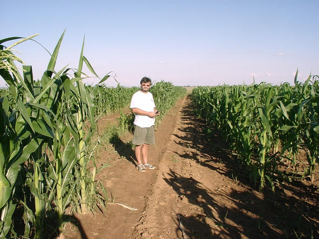
(visited by Hendrik van Eeden, Peet Nel and Hannie Nel) 20-Jan-2002 -- After an enjoyable day's climbing in the Magaliesberg, I decided to revisit this Confluence, as it was only about 30 km out of our way and I had some doubts about the second submission of this Confluence. The original visitor seemed to be at a trig beacon, and I found it unlikely that there would be a trig beacon exactly at the Confluence. We found the trig beacon easily enough - it was about 100 m off the tar road. I took some photos here and they clearly match up with those submitted previously. However, at this point we were still about 3 km from the actual Confluence. After getting permission from the farmer (hooting at the locked gates in the fence around the farm house until the farmer woke up) we drove off past an old homestead and accross some unplanted fields. We eventually reached the Confluence inside a maize field. |
| All pictures |
| #1: View north #2: View west #3: View south #4: View east #5: GPS screen showing coordinates #6: Peet standing at the Confluence #7: Peet and Hannie at the bakkie #8: Peet at the trig beacon about 3 km from the Confluence ALL: All pictures on one page |