|

Egypt : al-Buhayra
53.7 km (33.3 miles) SW of `Izbat Kafr Dāwūd, al-Buhayra, Egypt
Approx. altitude: 131 m
(429 ft)
([?] maps: Google MapQuest OpenStreetMap ConfluenceNavigator)
Antipode: 30°S 150°W
Accuracy: 6 m (19 ft)
Quality: good
Click on any of the images for the full-sized picture.


| 30°N 30°E (visit #1) |
![Visit #2: [06-Nov-04]](/eg/all/n30e030v2/preview.jpg "Visit #2: [06-Nov-04]")

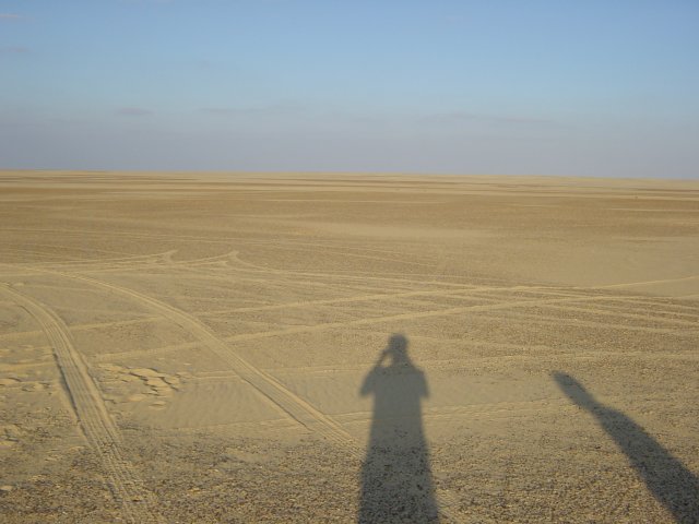
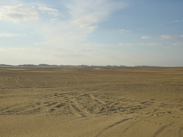
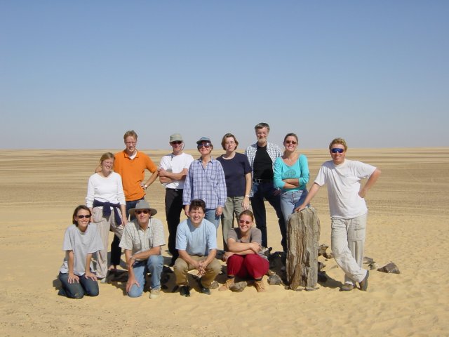
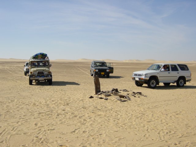
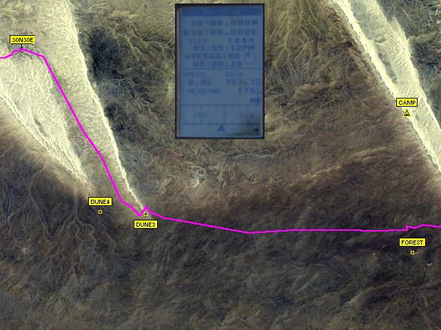
(visited by Christiaan Roelofs, Jet K, Willem K, Josefien K, Bart, Bieke, Tibet, Tinsi, Josien K, Loes K, Ingeborg S, Chloe S, Theo K, Henk, Hans P, Marlies N, Luuk S, Franske H, Mirjam W, David G, Jane G, Sander V, Anne V, Maaike S, Johan B and Max S) 24-Nov-2001 -- The plan to visit this Confluence already existed for a couple of weeks because I wanted to celebrate my 30th birthday near 30N 30E. After I e-mailed the invitation, David G. found the project on the web, another good reason to visit this point!!! On the 23rd of November we left Cairo around nine o'clock with two 4WD to meet with two other in Fayyūm, where the desert trip started. After three hours of finding our way up the escarpment through the desert towards the Baḥariyya road we finally managed to cross the railway that runs next to it. After crossing the road our first goal was an area filled with petrified wood. On our way there and to our final destination we had to pass several sand dunes, which are always tricky to pass, fortunately only one car got stuck a bit. Around four o’clock we arrived at our main objective of the trip: 30N 30E. Coming closer and closer to our destination we spotted an obstacle that turned out to be a piece of petrified forest. Taking the accuracy into account, it was very, very close to the Confluence! After we decided that this must have been the point we took some more pictures. Picture 2 is facing east and shows nothing more than an empty sand plain. Picture 3 is facing northwest and on the horizon you can see one of the large sand dunes covering this area, we had our campsite near this dune. The next morning, my actual birthday, we visited the Confluence once more for some more pictures. On the group picture you can see only one half of the group and on the other picture you can see some of the 4WD's. Finally, on the satellite image you can see the track we drove on our way to the Confluence and on the GPS you can find a perfect match! --------------------------- Co-ordinator's note: On January 28, 2003 the DCP received an information from Rich Ainsworth explaining for the strange pile of petrified wood, which can be seen on some of the pictures of this submission. Please find his message appended: I was intrigued to see your photos of 30N 30E in Egypt. And it's the first time I heard of your site and project. What you found was a cairn built by the members of the "30-30 Club" - a group of 4WD desert rats - during travels to that area in 2000-2001. Our group did a lot of travel in the Western Desert, and the dunes around 30N 30E were the closest good dunes to Cairo. They were great for a short weekend of desert travel. Used to spend a night out there and then head back to Cairo via Fayyūm. We had a requirement that anyone getting to 30N 30E and wanting to join the "Club" had to add to the pile of petrowood - lots of it are around that area of the desert. When we pegged the site 30N 30E for the cairn, the old built-in GPS error was still running. Later, when it was removed, we found that we were a little bit off, but not much, but didn't move the cairn for sentimental reasons (plus it would have been too much work!). Used to put some notes in bottles in the cairn, but found that they usually wound up broken by others visiting the site. Most of the members of the club are not in Egypt anymore, but a few still are. One who has put me on to your site. Excellent web site! – Rich Ainsworth, Northern Virginia |
| All pictures |
| #1: The Confluence represented by a piece of petrified forest #2: Facing east. #3: Facing northwest. #4: A group picture. #5: The 4WD. #6: A satellite image with the track and GPS ALL: All pictures on one page |