|

Turkey
2.8 km (1.7 miles) NNW of Nebiler, Antalya, Turkey
Approx. altitude: 1610 m
(5282 ft)
([?] maps: Google MapQuest OpenStreetMap ConfluenceNavigator)
Antipode: 37°S 150°W
Accuracy: 4 m (13 ft)
Quality: good
Click on any of the images for the full-sized picture.


| 37°N 30°E (visit #1) |
![Visit #3: [28-Sep-13]](/tr/all/n37e030v3/preview.jpg "Visit #3: [28-Sep-13]")
![Visit #2: [22-Sep-09]](/tr/all/n37e030v2/preview.jpg "Visit #2: [22-Sep-09]")
")
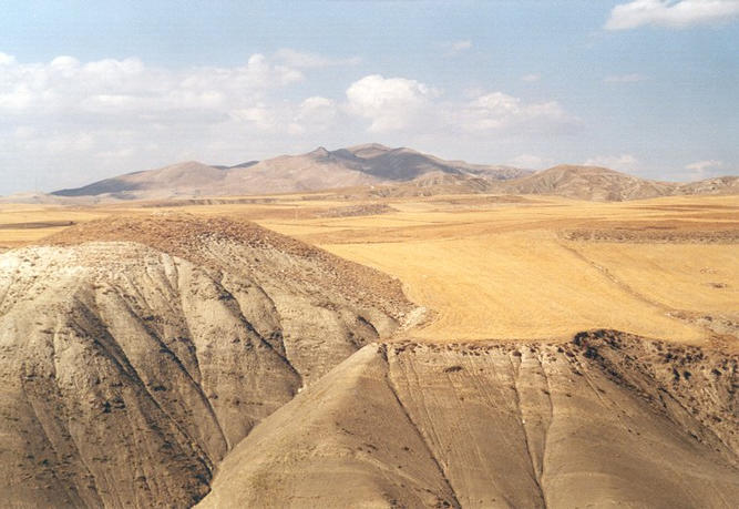
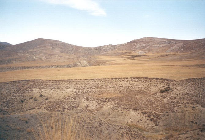
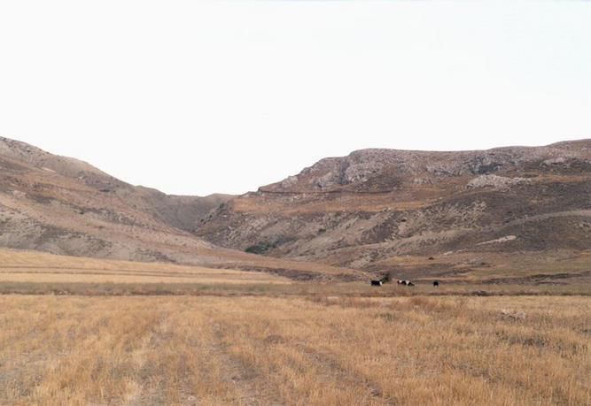
(visited by Gerhard Kaufmann, Jamila Ahejjam and Marwan Kaufmann) 14-Sep-2001 -- After our successful Confluence-rehearsal, re-visiting the already discovered 50°N 9°E two weeks ago, my wife, my son and me soon had the opportunity to sample a still undiscovered Confluence on the occasion of our vacation in Turkey. We rented a car in Kalkan, our residence, took the road D400 along the rocky steep coast of the Mediterranean Sea to Kaş, where we left the sea and headed on inland. The road crossed the coastal mountains, descended to a fertile valley and rose again in narrow and steep windings to Karaovabeli Geçidi ("Pass of the Black Plain's Saddle"), a pass 1552 m high. When descending to the valley of the Akçay River, we could see to the north the impressive bald mountains of the Ak Dağlar ("White Mountains"), rising up to more than 3000 m. Following the Akçay ("White Brook") in a fertile plain about 1000 m high with lots of apple trees, we arrived at the city of Elmalı, where we stopped for a short visit. Having passed the apple plantations and tempted by the city's name (elma = apple), we liked to buy some fresh and tasty apples, but to my great astonishment, we didn't find any! Neither in Elmalı nor alongside the country roads where local farmers sold grapes, pears, tomatoes, but no apples! Only once we saw large heaps of apples in the yard of a factory, maybe they are all pressed for apple juice or dried for apple tea? Question still to be answered... After leaving Elmalı, we took the road D635 leading to Korkuteli. After some time, I found a smaller road to the left with a signpost. We followed this road, again crossing a mountain ridge, and finally arrived at the small village Nebiler ("The Prophets"), which is close to the CP 37°N 30°E (Picture #2). Entering the village, we received a very unfriendly welcome by two ferocious dogs (luckily our car was between them and us). However, having made clear to us in no uncertain manner who is on guard here, they let us pass. In no time we had passed through the small village and having kept an eye on the GPS receiver since a while, we found that we now had approached the Confluence to the closest, and following the road would lead us further away. I stepped off the car to look for a way to get closer to the Confluence, but found myself in front of a fearfully deep erosion trench (in the foreground of Picture #3) with the Confluence still 2.4 km away and apparently no road or path led in the desired direction. As I could make out that the erosion trench began only a short distance away towards the village, we drove back a little and I took the decision to venture the remaining distance to the point on foot. We started hiking across harvested grain fields and uncultivated pastures covered with rubble and thistles. I tried to identify the grain, but for a long while I couldn't find a single ear on the ground, obviously the goats put out to pasture had done a good job. Later I found one single ear of barley. Following the arrow indicator on the GPS receiver straight towards the Confluence we passed amidst a herd of cows, their herdsman nearby gazed most amazed at the strange couple carrying a child, having appeared to him out of nowhere and walking on in a very decisive manner to a destination unknown to him. I wonder what he took us for... After nearly one hour of walking finally we approached the Confluence around 5 p.m. (UT + 3), we still had to cross another erosion trench, luckily the spot wasn't to be found in the trench, but amid the grain field beyond (Trench in the foreground, Confluence exactly in the middle of picture #1). I marked the spot 37°N 30°E with a stone (Picture #4), and as the sky was all open, the GPS receiver caught lots of satellites with strong signals and indicated a stable all-zero-display with an estimated accuracy of only 4 m, whereas the height was given as 1622 m (Picture #9). Only five minutes before arriving at the Confluence, the sun hid behind upcoming thunderclouds in the west (Picture #8), thus the wind was getting remarkably fresher and the pictures taken at the spot (Pictures #5, #6, #7) unfortunately lack a little brilliance. While walking back to our car, we found a track in the fields apparently coming from the village Nebiler and leading very close to the spot. Therefore, I could advise a future visitor of this Confluence to try to approach it by car possibly closer than we did. We returned to our car after two hours of confluence hunting, very tired and very happy and satisfied with our success and not wanting to miss one second of this adventure. |
| All pictures |
| #1: The CP 37°N 30°E from the south (Confluence exactly in center of picture) #2: The village Nebiler #3: View north across a deep erosion trench towards the Confluence, still 2.4 km away #4: My son and me at the confluence point #5: View towards north from Confluence #6: View towards east from Confluence #7: View towards south from Confluence #8: View towards west from Confluence #9: GPS receiver display ALL: All pictures on one page |