|

France : Auvergne-Rhône-Alpes
near Charbonnières-les-Vieilles, Puy-de-Dôme, Auvergne-Rhône-Alpes, France
Approx. altitude: 607 m
(1991 ft)
([?] maps: Google MapQuest OpenStreetMap ConfluenceNavigator)
Antipode: 46°S 177°W
Accuracy: 8 m (26 ft)
Quality: good
Click on any of the images for the full-sized picture.


| 46°N 3°E (visit #1) |
![Visit #8: [16-Feb-23]](/fr/all/n46e003v8/preview.jpg "Visit #8: [16-Feb-23]")
![Visit #7: [22-Dec-21]](/fr/all/n46e003v7/preview.jpg "Visit #7: [22-Dec-21]")
![Visit #5: [24-Jul-18]](/fr/all/n46e003v5/preview.jpg "Visit #5: [24-Jul-18]")
![Visit #6: [11-Jul-18]](/fr/all/n46e003v6/preview.jpg "Visit #6: [11-Jul-18]")
![Visit #4: [17-Aug-14]](/fr/all/n46e003v4/preview.jpg "Visit #4: [17-Aug-14]")
![Visit #3: [01-Sep-13]](/fr/all/n46e003v3/preview.jpg "Visit #3: [01-Sep-13]")
![Visit #2: [20-Mar-05]](/fr/all/n46e003v2/preview.jpg "Visit #2: [20-Mar-05]")

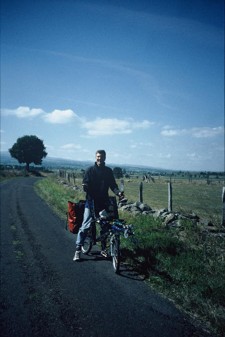
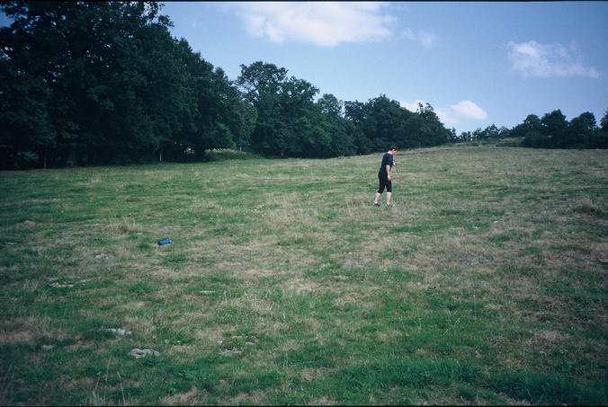
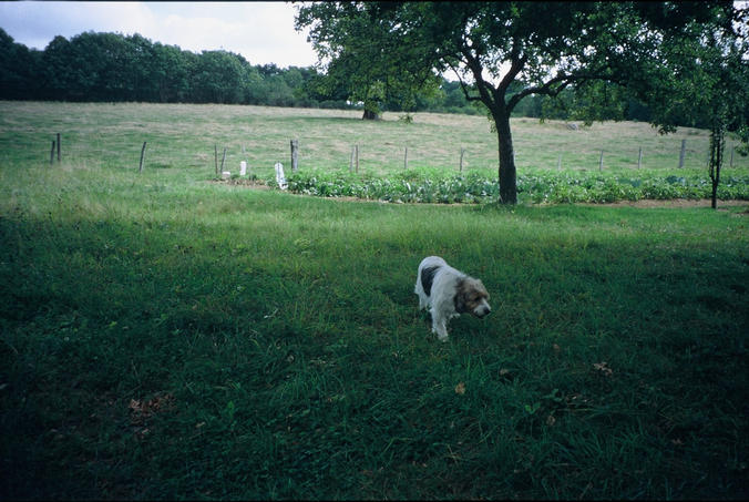
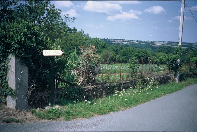
(visited by Barbara Loebau) 29-Aug-2001 -- On our three weeks cycling holiday (on a special kind of tandem) from Vichy to Millau, we went along the Gorges de la Sioule and came from the North along the road D16 which leads you after a small curve quite close along the longitude line 3°E. We cycled down to the south, watching the GPS, until we reached the latitude 46°N and left our tandem in the village Charbonnieres-les-Vieilles. We followed the GPS down the hill through meadowland - we had to cross a lot of fences - but then we reached a small road, only some hundred meters from the confluence point. We followed this road which led directly to a fenced garden at the right of the road. A glance at the GPS showed us that the confluence point might be amid this garden. We met an old lady with her grandchild standing there in her vegetable garden - as well as a small dog barking loudly when we came closer. I tried to explain to her, that the intersection of the 46th longitude and the 3rd latitude line takes place in the meadow just behind her garden. ‘Aha - thats why yesterday there was a man in this meadow over there taking photos - well I do not understand anything of those things, but if my children would be here, they could talk to you about it’, the woman told us - and she was right, the GPS pointed into the direction where she had seen the man yesterday. We walked uphill into the meadow - a nice place on earth with an old tree, close to the garden of the lady. You don’t have to cross her garden, on your left hand there is even a little path leading to the meadow with the confluence point. We took some photos - also of the dog of the lady. Then we went back to our bikes following the small road (... without climbing over fences...). If you also want to visit this nice place, you only have to follow the sign "Les Incas" from the main road D16. |
| All pictures |
| #1: the watchdog of the confluence point, just behind the fence #2: coming from the north on the road nr. D 16 just follow this road to the left at the end of the village Charbonnieres-les-Vieilles if you want to reach the confluence point #3: we've got it! #4: view to the north, my boyfriend Rainer Pfluger #5: view to the north #6: view to the west with myself #7: searching the confluence point #8: My boyfriend Rainer Pfluger with our tandem ALL: All pictures on one page |