|

Norway : Vest-Agder
16.1 km (10.0 miles) ESE of Farsund, Vest-Agder, Norway
Approx. altitude: 4 m
(13 ft)
([?] maps: Google MapQuest OpenStreetMap ConfluenceNavigator)
Antipode: 58°S 173°W
Accuracy: 5 m (16 ft)
Quality: good
Click on any of the images for the full-sized picture.

![]()


| 58°N 7°E (visit #1) |
![Visit #3: [20-May-11]](/no/all/n58e007v3/preview.jpg "Visit #3: [20-May-11]")
![Visit #2: [08-Aug-10]](/no/all/n58e007v2/preview.jpg "Visit #2: [08-Aug-10]")
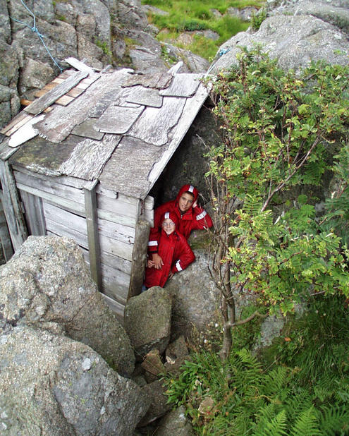
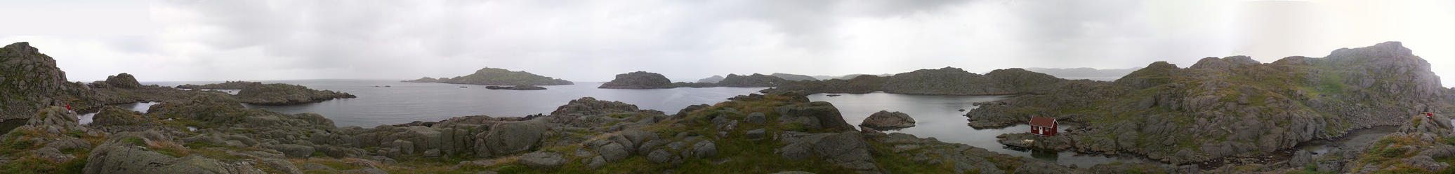
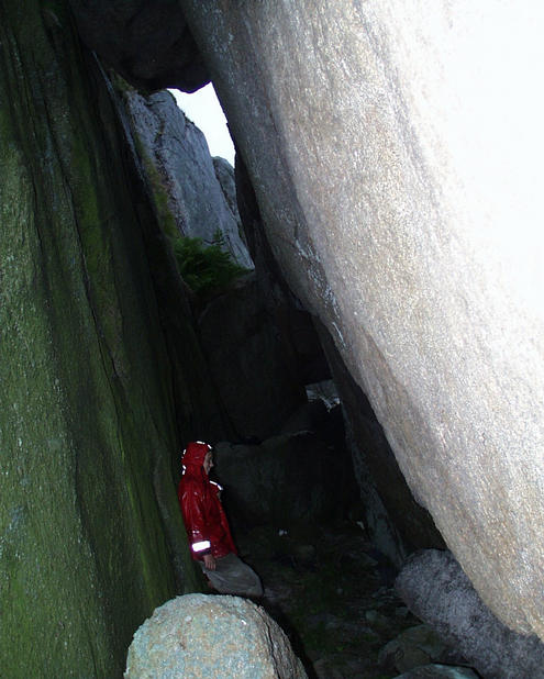
 (visited by Terje Mathisen, Fredrik Norløff-Mathisen and Cathinka Norløff-Mathisen) 21-Jul-2001 -- This confluence is a very special one, it is located on a small island just 2-3km from Lindesnes, the southernmost point in Norway. It is near the south-west end of East Seløy. The gap between East and West Seløy is closed by a rock mole, making this an excellent harbour just west of the Lindesnes light house. The Lindesnes area is known for strong winds (pic#2) and dangerous waves, so the Seløy harbour can be used as a shelter by small boats waiting for better weather before making the west to east crossing. The only way to get there is by boat, entering the harbour from the north. I had planned this trip since last year, and after a total of 5 days of sailing from Oslo, we arrived in Kristiansand, about 50km east of Lindesnes. The next day we sailed south-west towards Lindesnes, pulling into a natural harbour on the Være island just after lunchtime. We spent a couple of hours swimming in the cove and exploring the island, checking out the magnificent view from the cairn at the top of the hill (pic#3). As we pulled out again and moved south-west along the Lindesnes peninsula, the weather closed in, and we got a lot more wind and waves for the 1.5 hour trip around the light house (pic#4) to Sely. After anchoring up to the mole, the GPS gave the distance to the confluence point as 660m. Since we had to go around a couple of bays to get there, the actual distance was a bit more. There used to be sheep grazing on the island, but the very long grass indicated that there were no grazing animals this year. My kids found a small shack (pic#5), built entirely from drift wood and wreckage found on the rock beaches. Before reliable engines and good navigation systems this area had many ship wrecks. At the exact spot we had 10+ satellites all the time, giving an excellent position fix, but the dark clouds and light drizzle made it hard to get good photos. I made a panorama (pic#1) from a point 30m due north of the confluence, Fredrik and Cathinka are sitting at the exact spot. I also got a shot of the gps with all the required zeroes! (pic#6) On the way back we found a natural cave/tunnel, where several huge blocks had plugged the top of a ravine (pic#7). The final image (pic#8) shows the map, with our sailing track log (in red) around Lindesnes and into the harbour. The green track shows the trip to the confluence. Notice that the track is broken where we passed through the tunnel! |
| All pictures |
| #1: Panorama from the confluence #2: Windmills on the Lindesnes peninsula #3: View from Våre #4: Lindesnes light house #5: Drift wood shed #6: GPS #7: Natural tunnel #8: Track logs ALL: All pictures on one page |
| Notes |
|
On the small rocky islet Seløy in the North Sea, about 40 m inland from its shore. |