|

Burkina Faso
9.3 km (5.8 miles) N of Logué, Boucle du Mouhoun, Burkina Faso
Approx. altitude: 296 m
(971 ft)
([?] maps: Google MapQuest OpenStreetMap ConfluenceNavigator)
Antipode: 13°S 177°E
Accuracy: 10 m (32 ft)
Quality: good
Click on any of the images for the full-sized picture.

")

 near the Confluence")

| 13°N 3°W |

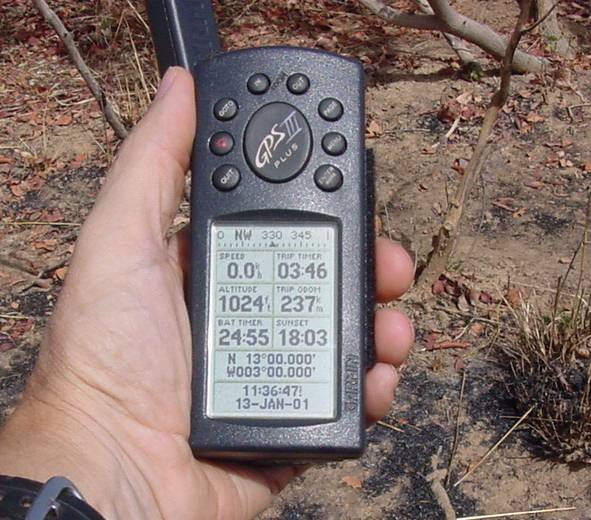
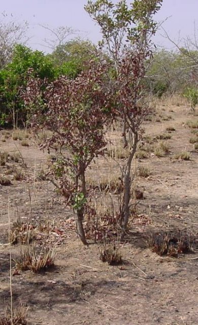
(visited by J. Baker Hill) 13-Jan-2001 -- I had to make a trip from Ouagadougou, where I live, up to Tougan, in the northwestern province of Sourou. As always I scanned the map for any Confluences I might visit, and found 13N 3W some 11 kilometers southeast of Tougan. It looked to be about three kilometers off the main road, which I thought might present a problem as I wasn't able to take a four-wheel drive vehicle, but I determined to walk it if I couldn't reach it any other way. Nearing the Confluence some three hours from Ouagadougou I saw the Samo village of Kassan, which I figured might have some farm trails leading to the general area of the confluence point. The first trail I took eventually led north instead of northeast as I desired, so I turned off and struck out along a donkey-cart trail. I was able to get within less than a kilometer of the point in the car, so I parked it under a tree and started off on foot with 750 meters to go. The "bush" was not thick and I was able to keep a fairly straight line, following by turns the map page, the direction finder, and the coordinates page of my GPS III+. Upon arrival I was able to get the "zeros" to show without much trouble and determined that there was a scraggly bush growing right out of the Confluence. The general area was uncultivated bush, but had been burned recently as it is not too far from a village. I keep hoping I will find a picturesque Confluence but there isn't much hope of that in this part of Africa. It seems most of the ones I have done are about the same; either a farmer's field or flat terrain with scraggly bushes. I will keep looking, though! |
| All pictures |
| #1: Looking northwest from the Confluence #2: On the numbers! #3: Looking southeast from the Confluence (note evidence of bush fires) #4: This bush is growing right out of the confluence point. #5: Some donkeys grazing (or trying to) near the Confluence #6: End of the line for the little Citroën, 700 meters from the point ALL: All pictures on one page |