|

United Kingdom : Scotland
6.4 km (4.0 miles) NNW of Cockenzie, East Lothian, Scotland, United Kingdom
Approx. altitude: 0 m
(0 ft)
([?] maps: Google MapQuest OpenStreetMap ConfluenceNavigator)
Antipode: 56°S 177°E
Accuracy: 25 m (82 ft)
Quality: good
Click on any of the images for the full-sized picture.


| 56°N 3°W |

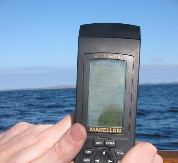
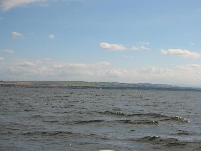
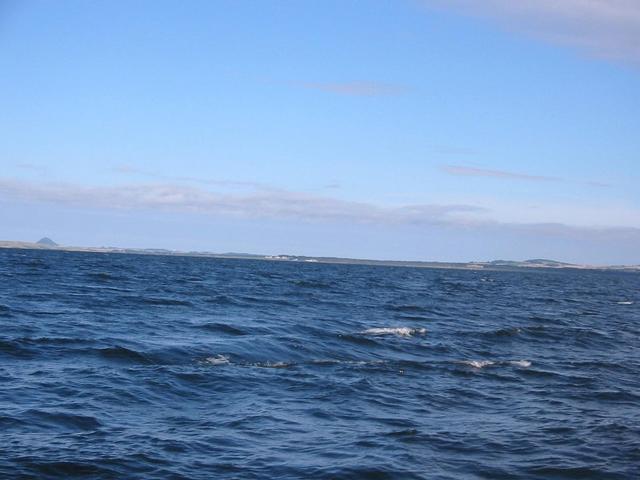
(visited by Richard Lloyd, Martin Little and Arthur Lloyd) 25-Aug-2002 -- This was my first attempt at a point of confluence and it was a great afternoon out. I arranged a boat, a GPS unit, a camera and did what I could with the weather. I travelled from Edinburgh with Martin Little, the photographer for the day and we met with my dad and the skipper, Commodore Arthur Lloyd. We set out from Aberdour harbour in our boat, Partan. The weather was fine with an easterly breeze but the water was calm enough for the attempt. We checked the charts at the boat house to take a few reference points along the coast line and set off. Finding the point was fairly easy, in the middle of the Firth of Forth the GPS coverage is perfect giving me no additional error over that of the 25m error stated in the unit's manual. Taking the picture of the GPS readout was somewhat more difficult as holding our position on the rising tide and avoiding the glare on the screen whilst bobbing up and down on the choppy water was not as easy as I had thought it would be. Finally Martin and I got the picture we wanted showing the position to be 56.00.00 N 3.00.00 W and I was happy. Some snaps North, South, East and West from our position and the task was complete. The journey home was a quick one with the wind and tide in our favour. We stopped breifly at Inchkeith Island for a bit of shelter while we topped up the fuel tank. It also gave us the opportunity to have a closer look at the wreck of the Switha. She struck the rocks in a snow storm in the late 1970s. I hope to have the opportunity to visit another point in the future it was a lot of fun. |
| All pictures |
| #1: View South #2: GPS #3: View North #4: View East #5: View West #6: Our boat 'Partan' ALL: All pictures on one page |
| Notes |
|
In the water, 3.5 km from shore in the Firth of Forth. |