|

Denmark
31.4 km (19.5 miles) E of Borre-Busene, Møn (Island), Storstrøm, Denmark
Approx. altitude: 0 m
(0 ft)
([?] maps: Google MapQuest OpenStreetMap ConfluenceNavigator)
Antipode: 55°S 167°W
Accuracy: 28 m (91 ft)
Quality: good
Click on any of the images for the full-sized picture.


| 55°N 13°E |

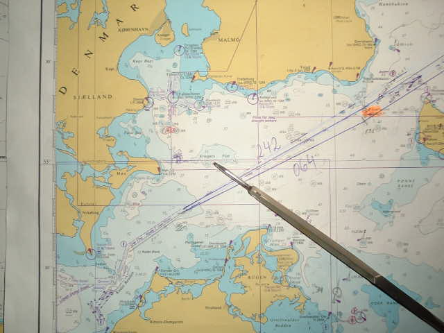
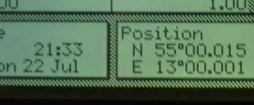
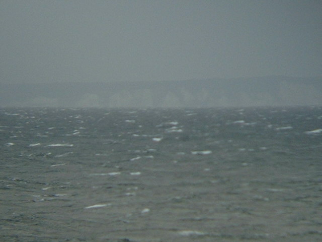
(visited by Captain Peter, Volodymyr Sydorenko and Stanislav Shulga) 22-Jul-2002 -- Coming from St. Petersburg and bound for Lorient (Brittany, France) today we visited 55N 13E, an additional Danish offshore confluence, about 30 km East of Møn Island, and just South of a patch of about 20 metres (11 fathoms) depth, called Kriegers Flak (Man-of-War Patch). In the North of the confluence there is Sweden, in its South is Germany with the island of Rügen, with its chalk rocks, under better conditions well visible from this point as well. The East Coast of Møn attains an elevation of up to 140 metres, of which the highest are the Kongsbjerg (King's Mountain) and the Dronningsstolen (Queen's Chair). Today there are gale force winds due to a low pressure over Southern Sweden. On its Western side strong NW-ly winds are blowing into the sea between Denmark and Sweden and the Western Baltic, quite rare in summer in this area. However, the clouds are now dissolving and this means, the worst is over. |
| All pictures |
| #1: The East Coast of Møn #2: Map #3: GPS #4: The clouds are now dissolving ALL: All pictures on one page |
| Notes |
|
In the ocean, with a view of land. |