|

United States : Wisconsin
2.8 miles (4.5 km) NW of Sand Island, Bayfield, WI, USA
Approx. altitude: 183 m
(600 ft)
([?] maps: Google MapQuest OpenStreetMap topo aerial ConfluenceNavigator)
Antipode: 47°S 89°E
Accuracy: 5 m (16 ft)
Quality: good
Click on any of the images for the full-sized picture.
")


| 47°N 91°W |

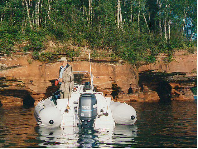
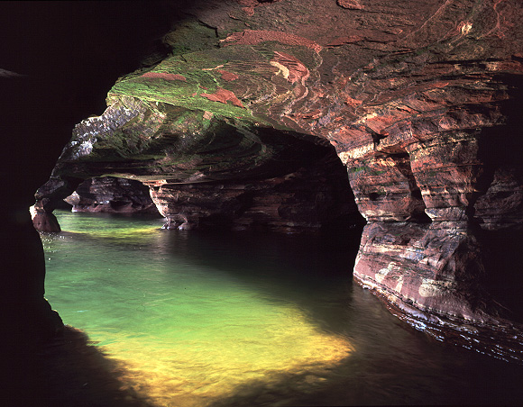
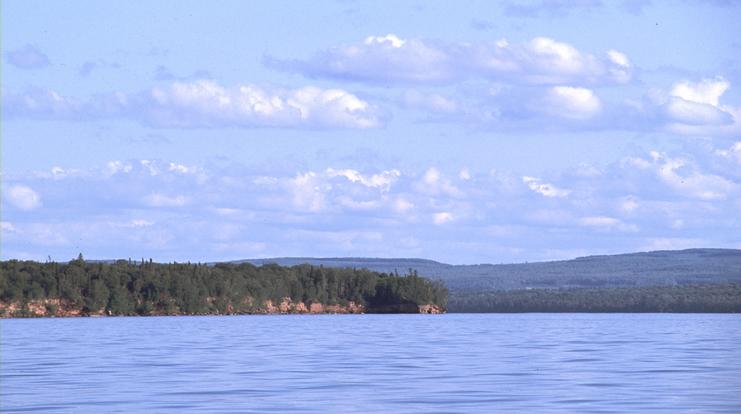
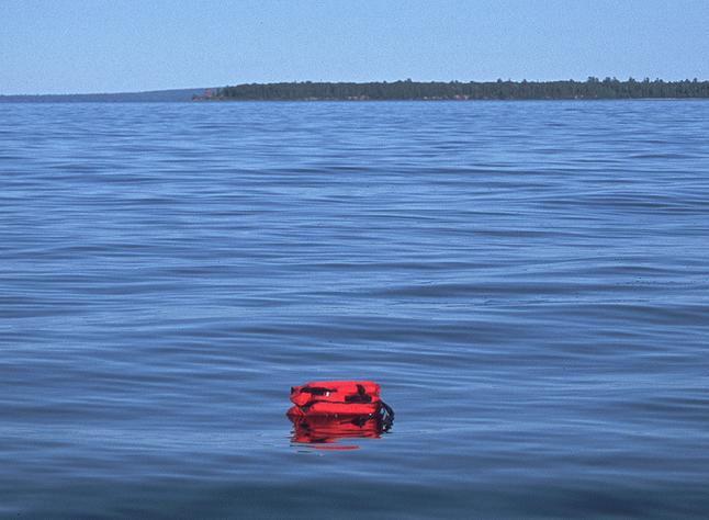
(visited by Jeff Shaw and Byron Shaw) 18-Aug-2002 -- This confluence is near the beautiful and remote Apostle Islands National Lakeshore – an archipelago of 22 islands extending into Lake Superior. The Lakeshore is a favorite destination for many hardy sailors, kayakers and photographers. Falling primarily into the latter category myself, and wanting to access the remote shoreline, islands and lighthouses so common around Wisconsin, I had recently purchased a large rigid-inflatable boat (see photo #6) – one capable of handling the gnarly, unpredictable conditions for which Lake Superior is notorious. The confluence is 6.8 km (4.2 mi) off the mainland, in water that rarely exceeds 60 degrees F. It would require at least moderately good conditions to visit safely. For months I eagerly waited for the relatively warm and calm weather of August before setting forth on the boat’s maiden voyage to Lake Superior. I invited my “crew” (a great opportunity to spend some quality time with my parents, Margaret and Byron Shaw), and set off for Bayfield Wisconsin, with the boat in tow. We arrived and immediately checked the weather forecast. It was not what I had hoped for – an unusually early fall weather pattern was setting in; 15-25 knot winds for the next day, followed by a 45-50 knot gale and waves to 18 feet the next. We would have to wait. Finally, on the third day, it seemed the conditions were favorable – just 1 ½ ft waves near-shore, sunny skies and 74 degrees F. My dad and I launched the boat in the sheltered waters of the Little Sand Bay harbor, and then headed for Sand Island, which is positioned between the confluence and the harbor. The Sand Island shoreline is composed primarily of sandstone cliffs, some with networks of sea caves large enough to paddle a kayak through (see photo #7 & #8). The caves were located on the protected leeward side of the island, so we stopped to take a few photographs and enjoy the beautiful day. Now on to the confluence, which lies 1.3 miles off the other side of Sand Island. We wouldn’t know what the offshore conditions were like until we ventured past the quaint Sand Island Lighthouse (photo #5). Conditions seemed okay (1 1/2 ft chop and about 10 knot winds), so we snapped a few photos of the lighthouse and headed out to seek the confluence. Amazingly, as we proceeded out to the confluence, the wind and waves eventually disappeared. It was a surreal experience. It seemed getting to the exact location would be easy. However, even without the wind, maneuvering a boat to an exact point miles from shore while simultaneously trying to focus on and photograph a chart plotter at precisely the right time proved to be very difficult. We finally managed however, and then put a red lifejacket in the water to temporarily mark the spot and take photos from each direction (see photo #2 & #1). In looking at the GPS chartplotter, we realized that our boat and the lifejacket were adrift heading northeast at the rate of 1.9 kph (1.2 mph), even with little to no wind. As a result, it took continued effort to not only find the exact confluence, but to stay there as well. I then recalled from Holling Clancy Holling’s children’s book “Paddle-to-the-Sea” that there is indeed a current that proceeds around Lake Superior from the inlet of the Nipigon River, southwest to Duluth, then northeast around the Apostle Islands and on to Sault Ste. Marie. Finally, having taken sufficient photos and a few recordings (water surface temp. 55 degrees F) we proceeded back to Little Sand Bay harbor, this time going around the other side of Sand Island (see map, photo #3). As we neared the mainland, we were surprised to again encounter the same magnitude of wind and waves that unexplainably disappeared an hour earlier. We arrived safely at the Little Sand Bay harbor around 2 PM, feeling that our 27.3 km (17 mi) trip was a success. The following day we returned to the sea caves in a kayak, to photograph them from the inside photo #7 & #8). Distances from confluence: Mainland (Sand Point): 6.8 km (4.2 mi) Sand Island: 2.1 km (1.3 mi) Sand Island Lighthouse: 4.8 km (3 mi) Other side of Lake (Minnesota): 35.6 km (22.1 mi) |
| All pictures |
| #1: Looking east at lifejacket marking confluence, no zoom #2: Looking southeast from confluence (~2x zoom) #3: Route map #4: GPS reading #5: Sand Island Lighthouse #6: Sand Island sea caves, Zodiac boat & Byron #7: Inside sea cave #8: More inside sea cave ALL: All pictures on one page |
| Notes |
|
In Lake Superior, 3 km from Sand Island (Apostle Islands National Lakeshore). |