|

Spain : Baleares
14.5 km (9.0 miles) W of Islas Bledas (Islands), Ibiza, Baleares, Spain
Approx. altitude: 0 m
(0 ft)
([?] maps: Google MapQuest OpenStreetMap ConfluenceNavigator)
Antipode: 39°S 179°W
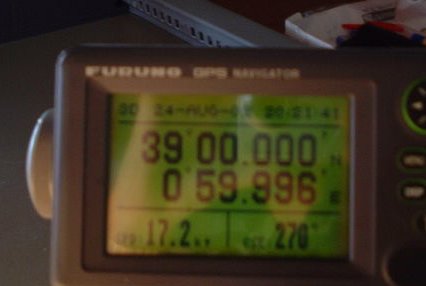
Accuracy: 6 m (19 ft)
Quality: good
Click on any of the images for the full-sized picture.


")


| 39°N 1°E |

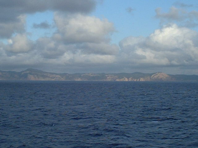
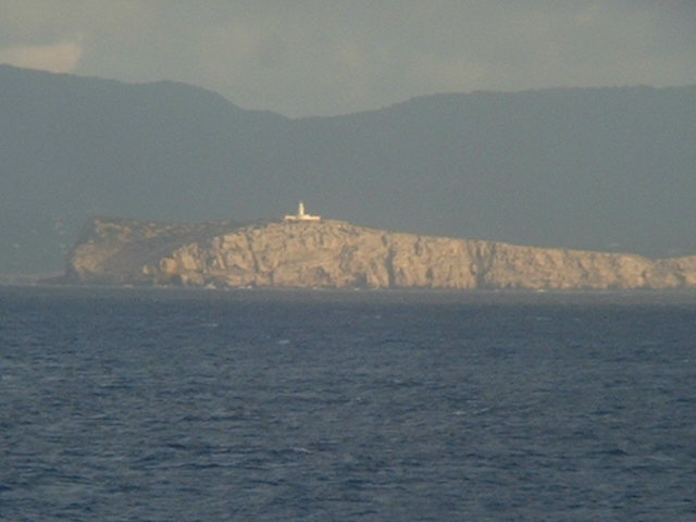
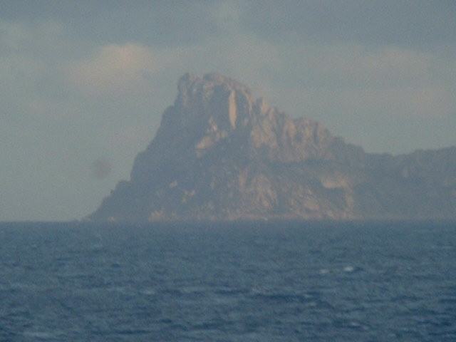
(visited by Captain Peter and Dimitriy Peysakhov) 24-Aug-2002 -- On August 16th I signed off my ship, the "Nova Scotia", in the Netherlands and went to my home in Italy for my vacation until Christmas. A four days later, on Aug 20th, the telephone rang at 9 a.m., and who pictures my pleasure when I learned who was calling me? My crewing agent from Cyprus! And certainly he did not call to congratulate me for my birthday on Aug. 23rd, but he had an emergency. A captain fell sick on a ship named "Sable Bay", actually berthed at Savona (Liguria, Italy), and in his desperation the crewing agent had no better idea than to call me for a short intervention. So, instead of 4 months I had only 4 days vacation, reluctantly and under grumbling I packed my bag and went to Savona in order to join the "Sable Bay", a refrigerated cargo ship as well. On August 23rd we left Savona, bound for Ceuta in Spanish Morocco (opposite Gibraltar), in order to refuel for our forthcoming trip to Natal (North-East Brazil) and Campana (Argentina). On the way to Ceuta we passed the North coast of Ibiza Island. Ibiza is a tourist resort for Europeans of utmost importance. My Chief Officer, Dimitriy, is already well known to me from a former employment, and so after a short briefing he was able to assist. The confluence is located 10 nautical miles (18.5 km) West of Isla Conejera (Rabbit Island), 69 metres high and with cliffy coasts. Its lighthouse stands on Cabo Blanco. As this was my first point in Spain, let me tell a brief breakdown of Spain's history: Spain, the national name of which is España, is descended from the Kingdoms of León, Castille and Aragon, which survived in the North part of the country after the Moorish conquest of 711 A.D. During the next 700 years these kingdoms gradually united, and at the same time pressed the Moors South. The final unification, brought about by the marriage of Ferdinand of Aragon to Isabella of Castille (the so-called "Reyes Católicos" - the Catholic Kings), took place in 1479, and the reconquest of the country was completed in 1492. Four months later, Columbus sailed on his voyage of discovery, the first step in the foundation of Spain's empire which, during the 17th and 18th centuries, included most of South America, Central America and the Philippine Islands. During the 19th century, Spain was rent by Napoleon's occupation and by civil wars and her colonies gradually became independent. After the 1931 elections, the king left the country in order to avert civil war, and a republic was set up which lasted until 1936, when a military revolt in Spanish Morocco led to the outbreak of civil war. The civil war ended in 1939, and the country was ruled by General Franco until his death in November 1975. King Juan Carlos I. took the oath as King of Spain a few days later. Castillian, commonly known as Spanish, is the native tongue of two-thirds of the population. Catalan is spoken in the NE of the country. On the Western side of Ibiza there are several cliffy islands, of which the highest one is Islote Vedra, attaining an elevation of 382 metres. We met the confluence with quite satisfactory accuracy, and with a final shot from the confluence to Ibiza we continued our voyage to Ceuta. |
| All pictures |
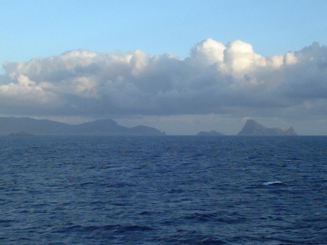
| #1: The scenery seen from the Confluence #2: The North coast of Ibiza Island #3: Map #4: Isla Conejera (Rabbit Island) #5: Islote Vedra #6: GPS ALL: All pictures on one page |
| Notes |
|
In the sea, but with a view of land |