|

Portugal
1.9 km (1.2 miles) S of Cabo de São Vicente, Faro, Portugal
Approx. altitude: 0 m
(0 ft)
([?] maps: Google MapQuest OpenStreetMap ConfluenceNavigator)
Antipode: 37°S 171°E
Accuracy: 19 m (62 ft)
Quality: good
Click on any of the images for the full-sized picture.


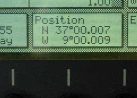
| 37°N 9°W (visit #1) |
![Visit #2: [06-Apr-24]](/pt/all/n37w009v2/preview.jpg "Visit #2: [06-Apr-24]")

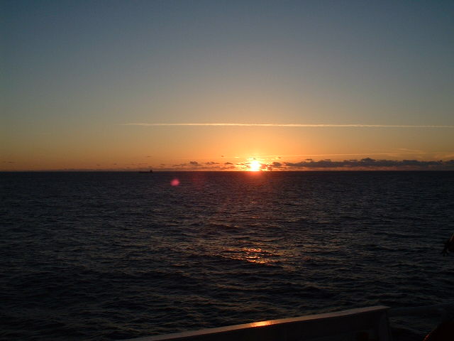
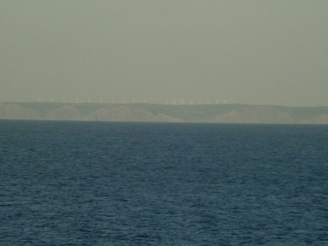
(visited by Captain Peter, Valentyn Smirnov, Volodymyr Kokorev and Volodymyr Sydorenko) 11-May-2002 -- After having visited 39°N/10°W we proceeded to the Southwestern tip of Portugal, the Cabo de São Vicente, a beautiful offshore point, which we reached at sunset. Between the steep and rugged points of Cabo de São Vicente and Ponta do Sagres (5.5 km SE) the coast is formed into a bay of inaccessible cliffs broken by two small sandy beaches. The W side of the cape is steep and precipitous, full of caves, such that the noise produced by the sea breaking on it may be heard at some distance. Gigante, a high isolated rock, lies close off the cape. Pôrto da Baleeira is a small harbor, used mainly by fishing vessels and recreational craft seeking shelter. In Southern Portugal, too, the wind is used to generate electricity. On the steep-to coast near Cabo do São Vicente the are several wind rotors. |
| All pictures |
| #1: Cabo de São Vicente #2: Map #3: GPS #4: Sunset #5: Wind rotors ALL: All pictures on one page |
| Notes |
|
In the water, 2.4 km from shore. |