|

Saudi Arabia : al-Riyād
17.1 km (10.6 miles) NE of al-`Uwaynid, al-Riyād, Saudi Arabia
Approx. altitude: 872 m
(2860 ft)
([?] maps: Google MapQuest OpenStreetMap ConfluenceNavigator)
Antipode: 25°S 134°W
Quality: good
Click on any of the images for the full-sized picture.


| 25°N 46°E (visit #2) |
![Visit #4: [16-May-03]](/sa/all/n25e046v4/preview.jpg "Visit #4: [16-May-03]")
![Visit #1: [21-Nov-01]](/sa/all/n25e046/preview.jpg "Visit #1: [21-Nov-01]")

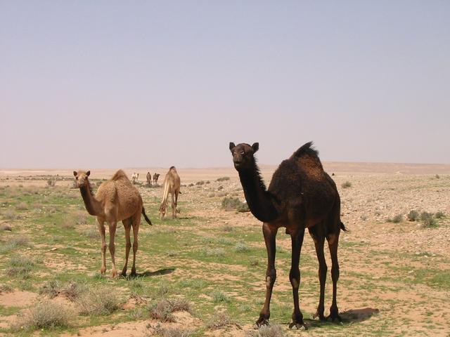
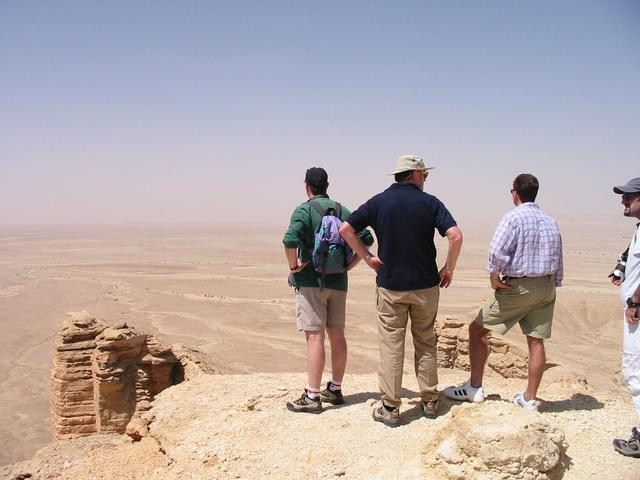
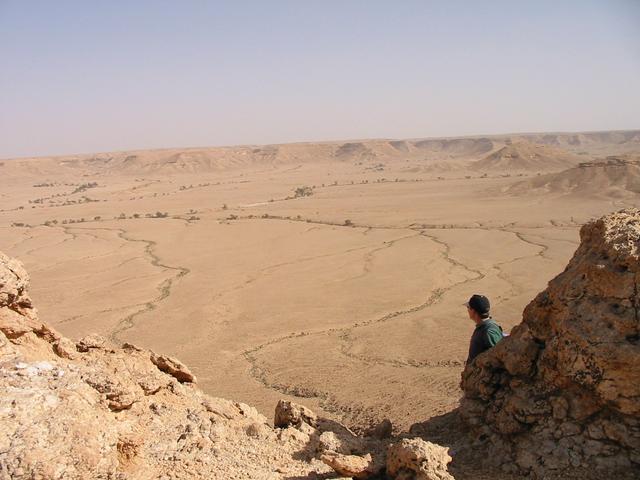
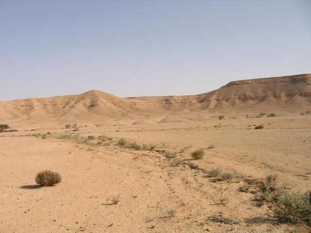
(visited by Alistair Rausch and Alan Morrisey) 14-Mar-2002 -- This seems to have been an elusive degree confluence point for some. The best result that has been achieved so far out of two previous attempts, has been to get within 600 meters of the point. So we decided to try our luck. And I do mean "luck", because maps of the area show insufficient detail to determine whether the point is located among the hills of the Ṭuwayq escarpment or in the flat valley below the escarpment. I gambled on it being in the hills. I had been taken camping to this area once before, so I knew of a route which I hoped would get us close to the Confluence. As this was a day trip, we set off early to give us time to explore if necessary. We drove for an hour on the tar and then turned off onto a dirt track at a village called Sudūs. In the company of two Nissan Patrols and a Nissan Pathfinder, the Galloper was feeling decidedly uncomfortable. The region had recently experienced the rarity of a few rain showers so the normally barren wādiys (valleys) had spluttered into life. Patches of green grass were receiving eager attention from the numerous camels that were grazing in the area, while one of our party was giving the good-looking camels eager attention. And, the small dam wall that we passed, actually held back some water. We turned off the main track onto an almost indistinguishable track up a hill on to the higher plateau. The plateau was flat on the top but was dissected by many wādiys, which had carved steep valleys into the limestone. The track threaded its way between these wādiys along the high ground. We arrived at a point that was about four and a half kilometres from the Confluence and surveyed the scene. It seemed possible to take the vehicles about one kilometre closer (this would be over rocky ground and our tyres were not convinced that this was the best plan). We could then walk the last three and a half kilometres down a smaller escarpment, across a wide, flat wādiy (about 2 km) and up another small escarpment (hopefully only the one). However, if we could drive the vehicles down into the wādiy, we could get much closer. Being lazy (and using our tyres as an excuse), we opted for the second plan. As we were so close to the Edge of the World, we decided to visit this site first. This is a point on the edge of the Ṭuwayq escarpment, which offers fantastic views out across the desert plains. Having marvelled at the views and fought off vertigo, we set off to find a way down into the wādiy. Unfortunately, we only found three possible routes into the wādiy. The most promising one led to an old quarry but the road from the quarry into the wādiy had been deliberately blocked off with huge boulders. The second possibility led to a dead end. The third possibility took us to a point in the wādiy, which had been totally blocked off by a substantial fence. It was now lunchtime so we found a suitable place to feast and pondered our situation. Enthusiasm was beginning to wane for some but not all. We eventually decided that two vehicles would go back to plan "A", while the other two vehicles would return to Riyāḍ (wimps!). On returning to the point on the track where we were closest to the confluence point, we inched closer over the rocks until we were within 3 kilometres of our destination (the tyres were not happy). We left the vehicles perched on the top of the escarpment lip and clambered down the loose scree with our water, GPS, camera, etc. We picked up the pace as we crossed the flat wādiy floor and tested our lungs up to the top of the ridge on the far side of the wādiy. Breathing heavily, we took a GPS reading from there, only to discover that we were still 800 meters from the confluence point. Worse still, there was a deep valley and another ridge between us and it. So down we clambered and up the other side. Another GPS reading. Nuts, still another 400 meters to go. So down we clambered again, hoping that the confluence point would be in the small wādiy rather than up the other side. Fortunately, our hopes were realized and at 3:30 pm we were standing on another degree confluence point. The site was very scenic compared to most of the degree confluence points that I have visited in Saudi Arabia. We were in this small wādiy surrounded by hills. The wādiy had a sandy floor and there was some greenery to contrast with the white sand. We took the mandatory photographs and patted ourselves on the backs for our perseverance. We made a cross out of some rocks to mark the point in case another visiting party visited the point after us and managed to submit their visit before us. With the success behind us, we took our time on the return walk, taking time to enjoy the views. Actually, we were getting tired and this was an excuse to sit down for a rest. Our vehicles were patiently waiting for us as we replenished our spent energy with cool drinks. This was my best degree confluence visit yet because firstly, we had to work hard for it, and secondly, the effort gave us the privilege of witnessing some fantastic desert scenery that very few people have experienced. |
| All pictures |
| #1: A view looking back on the route that we had walked. #2: One of the beautiful panoramic views from the Edge of the World. #3: The wide wādī that we walked across. Note the cars on top of the escarpment in the top left corner. #4: Re-hydrating at the degree confluence point. #5: Some good-looking camels that we encountered. #6: A dam with real water rather than a mirage. ALL: All pictures on one page |