|

China : Guǎngdōng Shěng
7.1 km (4.4 miles) ESE of Tangping, Guǎngdōng, China
Approx. altitude: 360 m
(1181 ft)
([?] maps: Google MapQuest OpenStreetMap ConfluenceNavigator)
Antipode: 22°S 68°W
Accuracy: 5 m (16 ft)
Quality: good
Click on any of the images for the full-sized picture.


| 22°N 112°E |

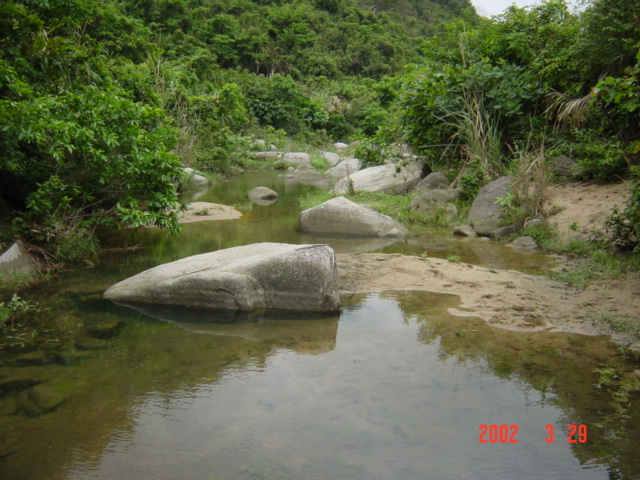
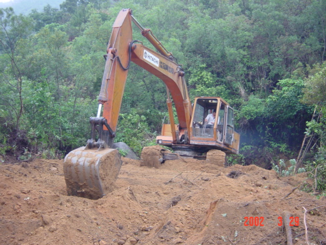
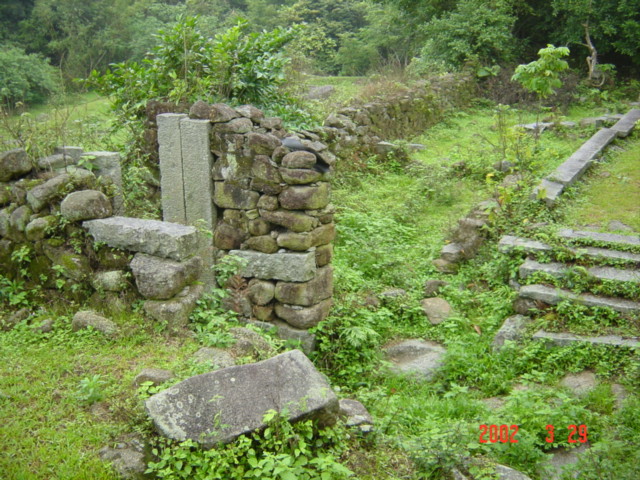
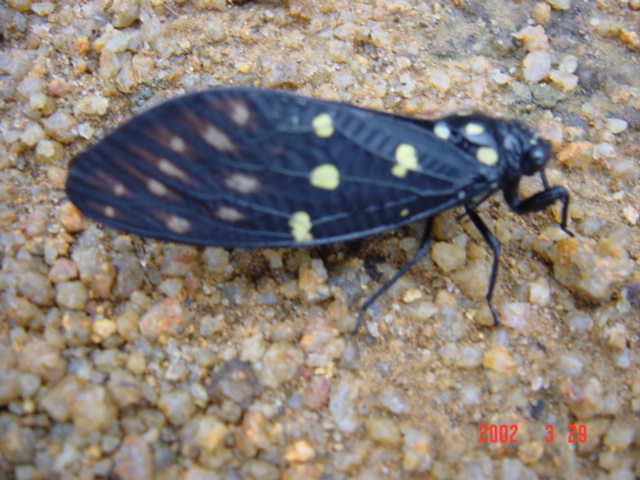
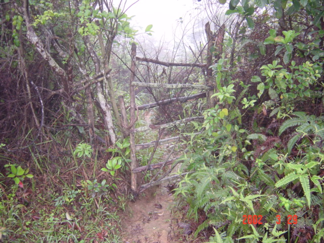
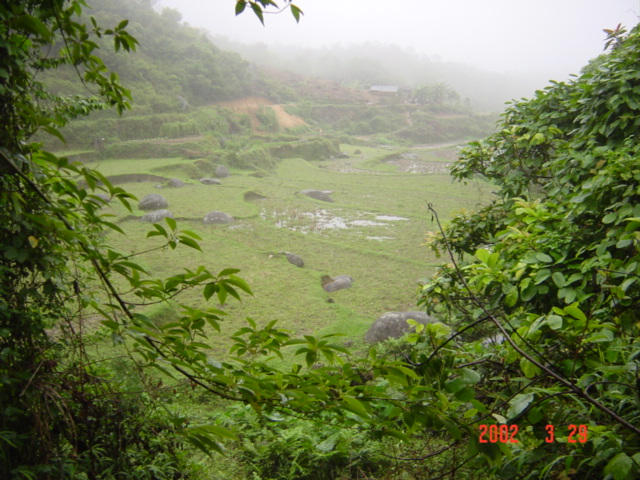
(visited by Targ Parsons) 29-Mar-2002 -- THURSDAY 28 MARCH 2002. I left Hong Kong after work on Thursday evening, at the start of the Easter break, and at the start of what was to be a 10-day confluence-hunting expedition to mainland China. I managed to beat the crush at the Shenzhen border crossing, and got to Guangzhou by 9:30 p.m. In Guangzhou, I had to wait an hour before getting another bus to Yangjiang, which didn't arrive in Yangjiang until 1:30 a.m. Yangjiang is 15 kilometres SSW of the confluence. There was a nice, clean, inexpensive hotel right across the street from the bus station, so I didn't have to go searching for one. Two bright yellow gas masks hung prominently on the wall just inside my room. Happily, they were not required during my stay. The sound of people playing mah-jong in a room across the hall, plus the traffic and pedestrians (a surprising number for that time of night) going noisily to and fro outside my ground-floor window, kept me awake for a short while. But eventually exhaustion blotted out all else, and sleep came. FRIDAY 29 MARCH 2002. I awoke at 7 a.m., had a hot shower, then ventured outside. At the bus station opposite, I bought a local map, checked the timetable for buses to Leigang, and ate some breakfast. Then I crossed back to the hotel to check out, leaving my bag at the reception desk. It was a warm and humid morning, with only a very light drizzle, so I took a chance that it would fine up later, and left my raincoat in the bag at the hotel. A mistake! The 8:40 a.m. bus to Leigang was a "trawler" bus. We spent half an hour cruising the streets of Yangjiang, searching for additional passengers, before finally getting under way. Once we got going though, it was a relatively quick journey, and I disembarked in Leigang at 9:45 a.m. I was now five kilometres NE of the confluence. From Leigang, I took a motorbike as far as I could towards the mountain village of Muxiang, before the rider protested that the track was simply too narrow and muddy to proceed further (and he was right). Still 3.3 kilometres from the confluence, I continued on foot, following a river upstream between two mountains. So far the rain was holding off, and the sun was even struggling to emerge. At one stage, I made a wrong turn, mistakenly following an irrigation ditch that led away at right angles to the river. Even worse, while attempting to take a shortcut to get back to the correct path, I lost my footing and fell quite heavily. I was extremely lucky not to have done myself a serious injury. I reminded myself to be more careful. The path crossed the river (picture #2), and shortly thereafter improved considerably, leading me to suspect that there might in fact be a better way in. My map showed only one "road" going in though, which was the narrow muddy path that I had just come up. It was very peaceful as I made way along -- many birds singing, butterflies fluttering by, and the occasional isolated roadside dwelling. I took to carrying a stick as I made my way past the latter, lest there be an unfriendly dog unaccustomed to strangers. The road just kept getting better and better, although there was absolutely no vehicular traffic whatsoever, and extremely few pedestrians. At 1.5 kilometres SE of the confluence, I reached the tiny village of Gaoji. Here I saw a beekeeper inspecting honeycomb from one of his hives (picture #3). I resisted the urge to take a closer look, not just because of the bees, but also because of his dog! About half a kilometre further on from Gaoji, there was an inviting side road leading off to the right in the direction of the confluence, however I passed this by. My map told me there should be another village called Hongmian further up the road, only a few hundred metres from the confluence. I thought it best to aim for Hongmian first. At 11:20 a.m., just as I was approaching another fork off to the right, I met a peasant on the road. He informed me that this was the turn off I must take to get to Hongmian. If I hadn't run into him just at that precise moment, I probably wouldn't have taken this turn either. Luck seemed to be smiling on me. As I made my way towards Hongmian, a motorbike approached from behind. This was the first traffic I'd encountered since parting company with the motorcyclist who'd given me the lift from Leigang that morning. This new motorcyclist gave me a lift for a short distance, but then the road became very steep and muddy, and suitable really for only one person on a motorbike, so I continued on foot once more, now only one kilometre SSW of the confluence. Light rain began to fall, and of course, my raincoat was in my bag back at the hotel. It was quite warm though, so the conditions were not all that unpleasant. Just wet. At 830 metres WSW of the confluence, there was a brand new road leading off to the right, directly towards the confluence. I couldn't pass this one up! I got as far as 640 metres from the confluence before the road abruptly ended. There was a large piece of earth-moving equipment working feverishly (picture #4), and a few people standing around, including the motorcyclist who'd just given me the lift. He explained that this was not a road-building exercise, but merely a land-clearing operation, making space for more crops. So I headed back down to the main road, and followed it along until I reached the village of Hongmian, which turned out to be long since abandoned (picture #5). Hongmian -- or what was left of it -- lay 750 metres NW of the confluence. I followed a stream up a hillside, through heavy, dew-covered foliage. It was a hard slog. Between the dew and the intermittent rain, which was now becoming heavier, I was soon completely drenched. By 1:15 p.m., I had reached the summit of a relatively high hill, 345 metres from the confluence. It offered a good all-round view, or at least it would have, had it not been enveloped in clouds and mist. Every now and then the mist cleared just enough to see a small patch of the surroundings. I was able to make out, in turn, the earth-moving equipment, the ruins of Hongmian, and another hilltop off in the direction of the confluence. I made my way towards the latter. There was a path of sorts, and although it was quite muddy and slippery, it was certainly a whole lot easier than fighting my way through dense foliage. I reached the next hilltop 20 minutes later. Here I was greeted by a deafening cacophony of insects, which sounded like cicadas, but looked more like moths (picture #6). This hilltop was only 135 metres west of the confluence. I descended the opposite side of the hill, where I found a rickety old gate, and let myself through (picture #7). Following the path down, it soon emerged into a valley of rice paddies. The confluence was just a few metres off to the right of the valley, and very easy to reach. A perfect reading was no problem (picture #8). Elevation: 368 metres. While standing at the confluence point, I could hear the sound of children's voices in the distance, and looking back over the valley to the east, I could just make out a farmhouse through the rain and mist (picture #1). The fields were strewn with many large boulders, apparently not worth the effort to clear them away. At least some of them were put to good use however, such as this one, which had a sign painted on it reminding one that outdoor fires were strictly forbidden (picture #9). On this rainy day though, I don't think an outdoor fire would have posed much of a threat. It was now 2 p.m., and I was feeling quite hungry. (But not thirsty. Since the rain had started, I had been enjoying the slow but steady trickle of rainwater collected by my moustache!) I made my way across the rice paddies to the farmhouse, where a farmer was sawing logs as his two young daughters played nearby. The farmer kindly offered me lunch, consisting of pork, dried fish and rice. The rice, of course, had been grown right outside the door! As I sat at the table eating, the farmer retired to the other side of the room, to puff away on his enormous bamboo bong (picture #10). I continued down the valley along a good path, which I fully expected to be the first promising side road that I had declined to take earlier that morning. But it wasn't. Instead of rejoining the main road 500 metres beyond the village of Gaoji, it led all the way to Gaoji itself. Rather than return to Yangjiang via Leigang, the way I had come, I decided to follow the ever-improving road southwards, continuing on past the turn-off to Hongmian this time. I walked for over an hour, during which time only one motorbike passed going my way (the rider didn't offer me a lift), and one tractor going in the opposite direction. I guess the rain, which was now constant, was keeping people indoors. At 4 p.m. I arrived at Dong'an, where several people were sitting in a shop playing mah-jong. One of them said he was leaving for Yangjiang shortly, and offered to give me a lift on his motorbike. It was only later that I found out he was a policeman. He was very kind. Before we left, he had me take off my sopping wet shirt, and gave me a dry shirt and raincoat to wear instead. Once we arrived back in Yangjiang, he dropped me off right in front of the hotel where I'd left my bag. He absolutely refused any money for the ride, and furthermore, insisted that I keep the dry shirt he'd given me to wear. So it became a useful, new, bright purple addition to my wardrobe. The time was only shortly after 5 p.m., but I was feeling very tired, so decided to check back into the hotel for another night, in preference to immediately hitting the road in search of the next confluence. After a hot shower, a change of clothes, dinner, and a visit to a hairdresser, I was feeling human once more. I was still extremely tired though, and was in bed asleep by 8 p.m. This story continues at 24°N 113°E. |
| All pictures |
| #1: Facing east #2: Mountain stream #3: Beekeeper inspecting honeycomb #4: Clearing land for cultivation #5: The ruins of Hongmian #6: Very noisy insect #7: Rickety old gate #8: N 22°00'00.0", E 112°00'00.0" - raindrops on the GPS #9: Boulder with sign #10: Farmer puffing away ALL: All pictures on one page |