|

Brazil : Espírito Santo
57.8 km (35.9 miles) NNW of Ilhas Martin Vaz (Islands), Espírito Santo, Brazil
Approx. altitude: 0 m
(0 ft)
([?] maps: Google MapQuest OpenStreetMap ConfluenceNavigator)
Antipode: 20°N 151°E
Accuracy: 19 m (62 ft)
Quality: good
Click on any of the images for the full-sized picture.


| 20°S 29°W |

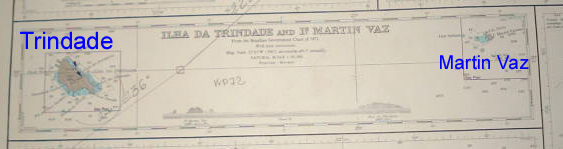
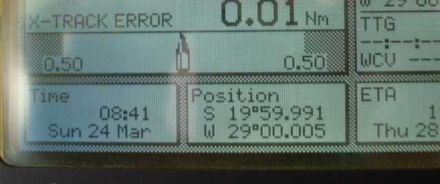
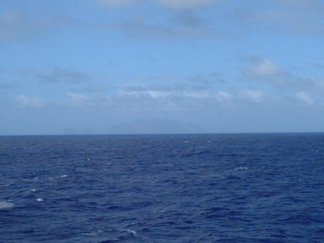
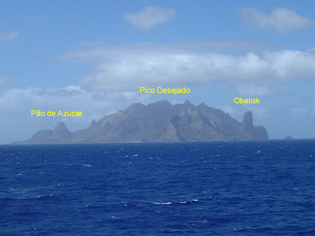
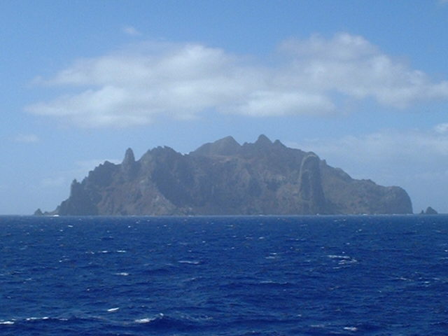
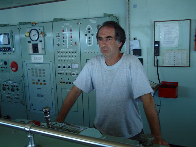
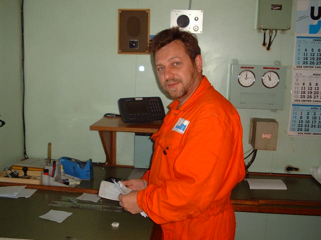
(visited by Captain Peter, Volodymyr Sydorenko, Valentyn Smirnov and Volodymyr Kokorev) 24-Mar-2002 -- After having passed Ascension Island we continued sailing to Montevideo, in order to refuel the ship there prior proceeding to the Paraná-River (Argentina) for loading mandarins, lemons, apples and pears for Russia. There are various offshore island groups, seamounts and banks which lie in the Atlantic Ocean to the East of South America. Some of these lie in the path of some of the major ocean routes leading from Europe and Africa to South American ports. Most of these offshore islands and banks are located within two distinct areas: the Northern Group which extends up to 500 n. miles NE and 600 n. miles WNW of Cabo Calcanhar, and the Southern Group that extends up to 620 n. miles East of the mainland between the parallels of 15°S and 22°S. Ilha da Trindade, together with Ilhas Martin Vaz is part of the Southern Group. The islands are volcanic in origin, generally steep and rocky with shoals and isolated submerged rocks surrounding them. At 08:41 hrs am we were at the Confluence (only 18.5 m off in the NW) and could see Ilha da Trindade. The island of Martin Vaz is too low and could unfortunately not been sighted from the Point. Ilha da Trindade is a rugged, arid mass of volcanic rock which has several remarkable peaks, of which the highest is Pico Desejado with an elevation of 600 m (1,965 ft). We wanted to watch this island better and so we went closer In the SE of the island there is the Morro Pão de Azucar (Sugarloaf Mountain), 391 m (1,284 ft) high, called so due to his perfect resemblance to the famous mountain at Rio de Janeiro. On the NW side there is a conspicuous peak in the form of an obelisk or cylinder, slightly inclined and named Pico Monumento. It is 428 m (1,406 ft) high. The coast is steep and almost enitrely fringed by coral reefs and ledges of rock on which the sea breaks with great violence. There are a few small beaches where landing is possible, but only during offshore winds. On the NE coast of the island there is a military garrison. We passed Ilha da Trindade on its West side. Chief Officer Valentyn Smirnov from Sevastopol (Ukraine) is carefully watching the operation from the Engine Control panel. This time Captain Peter introduced another crewmember to the Confluence Project, too. It is our Second Officer, Volodymyr Sydorenko from Odessa (Ukraine). On the picture he is studying the plan of our visit, well according to the motto: "Plan what you do - and do what you plan"!
-------------------------------------------------------- |
| All pictures |
| #1: Ilha da Trindade seen from the Confluence #2: Map of island group #3: GPS #4: Map of Ilha da Trindade #5: Closer, clearer view of the island #6: Trinidade from the West #7: Chief Officer Valentyn Smirnov is watching the operation #8: 2nd Officer Volodymyr Sydorenko studying the draft of the report ALL: All pictures on one page |
| Notes |
|
Way out in the ocean, but within sight of Ilha da Trindade. |