|
India : Uttar Pradesh
2.5 km (1.6 miles) SW of Ahraurā, Uttar Pradesh, India
Approx. altitude: 135 m
(442 ft)
([?] maps: Google MapQuest OpenStreetMap ConfluenceNavigator)
Antipode: 25°S 97°W
Accuracy: 9 m (29 ft)
Quality: good
Click on any of the images for the full-sized picture.
| 25°N 83°E |

(visited by Warren Apel and Tricia Apel) 16-Feb-2003 -- Before leaving for our recent weekend trip to Varanasi, I checked for a nearby confluence and was happy to find one. From the hotel we stayed at, it's about 32 km due south on a major road, which wouldn’t take much time at all in a car. But there were no cars at all to be found, so we took an autorickshaw – a sort of three-wheeled motorscooter with a roof. With a max speed of around 25 km per hour, the trip took a dang long time. The scenery was nice – rural farm villages and green pastures. We weren’t able to explain to the driver why we were trying to go to the town we pointed him to. I said we wanted to look around. Tricia said birdwatching. He said that the area around that town was very beautiful, and that people often went there during wedding season for picnics. That was good to hear. Then he mentioned that the mountains there were very pretty. I was hoping for no mountains. On Mapquest, we found that the confluence was only a kilometer or so off road, so we had initially planned for a 30-minute drive each way, and a ten-minute walk into a field. When we got there (nearly 2 hours later) we looked out in the direction of the confluence towards a fairly tall, fairly steep hill. I’m not a great judge of distance, but we figured the confluence would lie at the base of the hill. We got to the base, and the GPS said we were still 600 meters away. So we figured maybe the top of the hill. We climbed it, but with no path to follow, and heavy thorns and bushes, it wasn’t easy. Once we got to the top, we could see the area in a scrubby, rocky valley where it looked like it might be. And another hill in the distance. We hoped that it wasn’t across that one, too. We ventured down the other side, into the valley, and across some rugged farmland. Most of the crops had been harvested, so all that remained was plant stubble, rocks, and turned dirt. A few farmers waved hello to us from a distance, but none were too disturbed by our presence. One came up and asked some questions in Hindi. Assuming he was asking us where we were going, we answered politely in English, and he nodded and kept working. I don’t think either of us understood the other, but it worked out. We’re lucky that the people here are so peaceful. Finally we reached the spot – right at the base of the second hill. It looks like the farmers are growing small trees there, perhaps to feed their livestock with. All the plants were small, with maybe 6 or 10 leaves. Could be Mountain Ebony, but I couldn’t identify exactly it as young as it was. We saw some blue Indian Rollers flying around the site – one of the most beautiful birds in India. Of course, being farmland, there were a few cows, oxen, and water buffalo around. After taking a bunch of photos, we headed back to the road. We decided instead of crossing the mountain, we’d go around it. That took us quite a bit out of our way, but it was a much easier path. We went through the lower part of the valley, through some lush green farmland, where there was much more activity. Women in bright saris were harvesting mustard and some green plant with small blue flowers. We made it around the mountain and back to the road, then a brief walk down the road to where the rickshaw was parked. |
| All pictures |
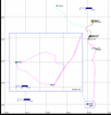
| #1: Looking North from the confluence point #2: The autorickshaw and driver we took from Varanasi to the site #3: After leaving the road, we went through this field. The confluence is just beyond the hill straight ahead. #4: The view from the top of the hill. The rickshaw is parked along the road, visible in the upper left of the photo. #5: Route map showing the path. Varanasi airport is in the upper left, the holy Buddhist city of Sarnath is in the upper right, the holy Hindu city of Varanasi is in the middle right, and the confluence is to the south. #6: View of the confluence, from the top of the hill. The arrow points to the general spot, at the base of the farthest hill. #7: Tricia's hand, holding the GPS for proof #8: Panoramic view #9: Tricia on the spot #10: Warren on the spot ALL: All pictures on one page |


