|

China : Húnán Shěng
8.9 km (5.5 miles) SW of Xiapu, Húnán, China
Approx. altitude: 152 m
(498 ft)
([?] maps: Google MapQuest OpenStreetMap ConfluenceNavigator)
Antipode: 27°S 67°W
Accuracy: 5 m (16 ft)
Quality: good
Click on any of the images for the full-sized picture.


| 27°N 113°E |

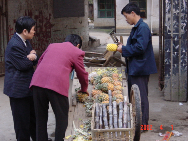
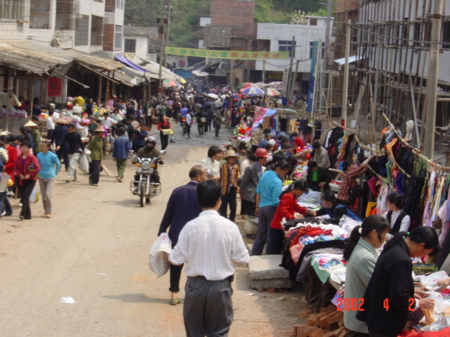
(visited by Targ Parsons) 02-Apr-2002 -- This story continues from 26°N 113°E. MONDAY 1 APRIL 2002. Shortly after 2 p.m., I took a train from Chenzhou to Hengyang, a journey of an hour and three quarters. This time there was no carriage captain forcing me into the embarrassing position of occupying someone else's seat, and I did the journey standing up. Shortly after 4 p.m., I left Hengyang on a bus bound for Hengdong, 11 kilometres north of the confluence. After checking into a hotel, I went for a walk around town while there was still some remaining daylight. I passed by a street hawker selling pineapples and sugar cane (picture #2). He was carefully cutting away all the inedible outer bits of each pineapple he sold. Then I went to enjoy some traditional Hunanese cuisine, which means hot! I had a bowl of snails in a very tasty mixture of hot chillies and burning hot oil (picture #3). The method of eating this dish is to fish out the snails one-by-one from the mixture (trying not to burn one's fingers on the hot oil), then, with a short, sharp sucking action, get the meat protruding far enough out of the shell to be able to bite it off, being careful to separate it from the inedible, mushy upper bit. It requires some practice, and a toothpick helps for those stubborn snails that don't succumb readily to the sucking action. It's all worth it in the end though! TUESDAY 2 APRIL 2002. Wow! I slept for over 12 hours! And I would have slept longer had I not been woken by some nearby roadworks. I checked out of the hotel, leaving my bag there, and at 10:45 a.m. was on a bus heading south. Just outside Hengdong, the bus had to navigate through a busy street market, which slowed progress for a while (picture #4). The bus passed 1.15 kilometres NE of the confluence, but I'd forgotten to stock up on drinking water before leaving Hengdong, and being a hot sunny day, I decided to continue on to the small town of Hujiawan, 2.8 kilometres east of the confluence. I bought a couple of bottles of water there, and at 11:20 a.m. headed back off down the road on foot towards the confluence. I left the road at the nearest point, walked up a valley until I was 700 metres away, scrambled up a hill, found a path, and followed it until I reached the crest of the hill. From here I could see the start of a small valley on the other side. I crossed this valley and climbed to the crest of the hill opposite, where I was confronted by another very large valley, this one with many houses. I followed this valley up to the confluence, which was 20 metres up the hillside amongst dense, low growth (picture #5). Elevation: 149 metres. It was 12:25 p.m. It took me 45 minutes to retrace my steps back to the road. Once there, I didn't have to wait long before catching a passing bus back to Hengdong. This story continues at 28°N 113°E. |
| All pictures |
| #1: Facing east #2: Street hawker selling pineapples and sugar cane #3: Chilli snails #4: Street market #5: N 27°00'00.0", E 113°00'00.0" #6: Facing west ALL: All pictures on one page |