|

Norway : Buskerud
27.9 km (17.4 miles) NE of Rjukan, Buskerud, Norway
Approx. altitude: 925 m
(3034 ft)
([?] maps: Google MapQuest OpenStreetMap ConfluenceNavigator)
Antipode: 60°S 171°W
Accuracy: 5 m (16 ft)
Quality: good
Click on any of the images for the full-sized picture.


![]()


| 60°N 9°E (visit #1) |
![Visit #2: [01-Aug-14]](/no/all/n60e009v2/preview.jpg "Visit #2: [01-Aug-14]")
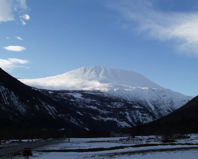
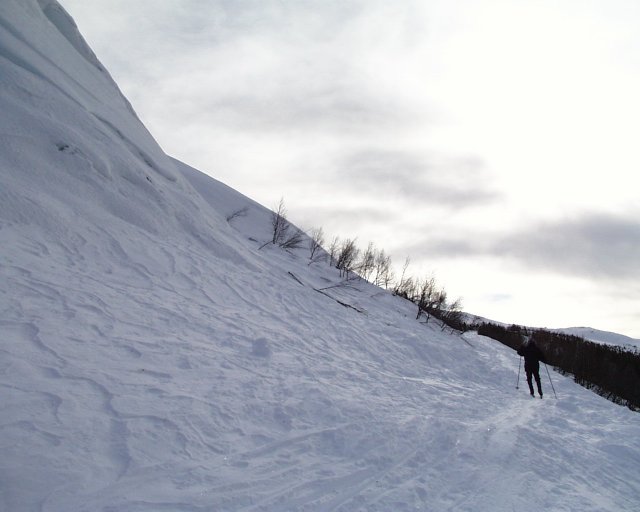
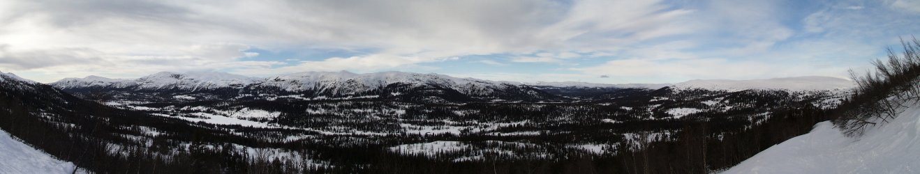
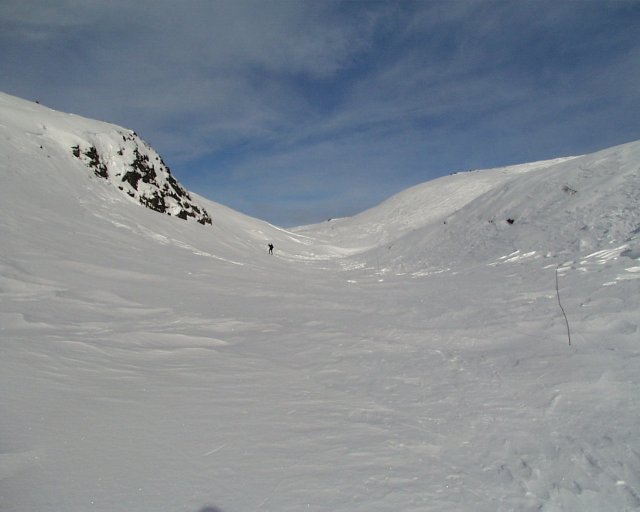
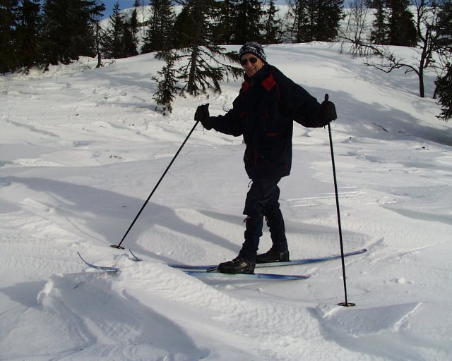
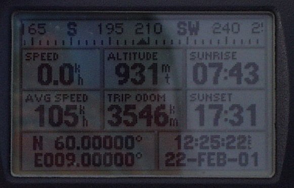
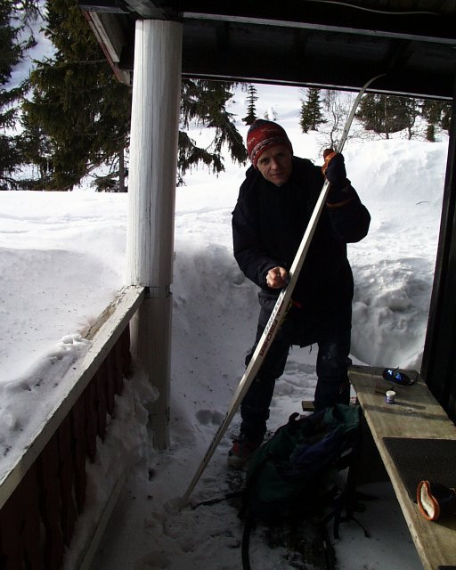
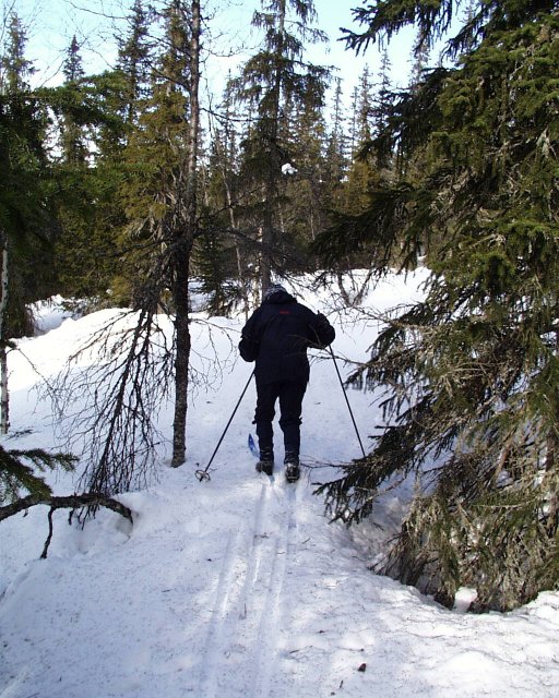
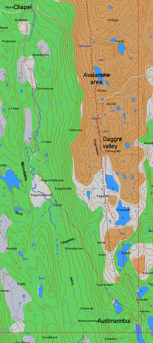
 (visited by Terje Mathisen and Hans Mathisen) 22-Feb-2001 -- I had planned this trip for almost a year, since the time when I indexed all the Norwegian confluences, and realized that this one is located in an area where I have skied several times, starting around 1974. None of these trips had ever passed directly over the confluence itself however, so I decided I had to make a new expedition to document the site. It is located very close to the border between the counties Telemark and Buskerud, up near the forest limit, which is somewhere between 920 and 1000m above sea level in this area. During summertime it should be possible to ride a mountain bike on some logging roads (which are barred to motorized vehicles) to a spot which is about 1.5 to 2 km from the confluence, but this would then leave you on the shore of the little lake which contains the actual degree crossing. In wintertime everything is frozen, but the nearest possible parking is about 9km away, at the Skirva Mountain Chapel. These chapels have been built in many popular touring areas, as a reaction to the way many Norwegians would rather go on a cross country ski trip instead of going to church on sunday. These mountain chapels make it possible to do both. To get there my father, Hans Mathisen, and I started in nearby Rjukan, a town in the northeast corner of Telemark county. This town was created just after the turn of the century by Hydro, the company I work for. Hydro was started by the inventors of the first process which made it possible to make artificial fertilizer. This process required immense amounts of electrical energy, and Rjukan was the site of an enormous waterfall which could be used in a hydro-electric power plant. Besides making fertilizer, Hydro at Rjukan also manufactured many secondary products. Among these was the first large-scale heavy water (D2O) production facility in the world, something which would become critically important during WWII: Heavy water is used in some forms of nuclear reactors, and allied intelligence reports indicated that the Nazis were trying to use this as a way to make a working atomic bomb. To stop this, Rjukan became the target for several sabotage operations to destroy both the production facility and the stores of partially refined heavy water. After several disastrous attempts to first bomb the facility, and then to attack it using a large group of commandoes landed with glide planes, allied command in London decided to try a small group of Norwegian special forces, all expert skiers, including several men from the Rjukan area. This group parachuted into the mountains above Rjukan, made contact with local resistance people, and then proceeded to climb down into the bottom of the river canyon, and up again on the opposite side where the factory was located. Since everyone, including the Germans, believed this to be impossible, they hadn't posted any guards at the back entrance to the heavy water plant. The Norwegian commando group managed to blow up everything before escaping back up into the mountains, without the loss of a single life, Norwegian or German! After being hunted by and evading several regiments of crack German mountain troops, they managed to ski the 400-500 km of mountains and valleys between Rjukan and security in Sweden. These events were later immortalized in a Hollywood movie starring Kirk Douglas: "Heroes of Telemark." Gausta, which is the highest, and in some ways also the most magnificent mountain in central Norway is located here, just above the current Hydro plant (photo #2). The top of this mountain affords a great view over a significant part of southern Norway, since there are no comparable mountains anywhere within about 250 km. On a clear day you can even see the ocean, which is more than 200 km away! Today on our confluence visit we drove east from Rjukan around lake Tinnsjø (where the ferry carrying the last of the heavy water supplies was sunk in a second commando action by parts of the same group who blew up the factory) and up into the mountains, in about an hour we made it to the Skirva trail head and put on our cross country skis. We first skied 2-3km further along the road that in summertime allows you to drive across a mountain pass called Killingskardet between Telemark and Buskerud, on the way up it became obvious why this road is closed in wintertime: It was totally covered by avalanches in a couple of spots! (photo #3) As we got close to the pass, we had a magnificent view over the surrounding mountains, with Rifsfjell due west. (photo #4) From the mountain pass we skied directly south, over some smaller hills and then followed a valley down to the twin Daggrø lakes. (photo #5) About 0.5 km east of these lakes, the unmanned Daggrø mountain cabin can be used for overnight stays. This cabin is one of many such shelters, some manned and some unmanned, that are maintained by the Norwegian Mountain Touring Association. The one at Mogen will be crucial for anyone who wants to make an attempt at N60 E008! Past the cabin we had to ski up and down over a number of hills and lakes, and the storm that had passed over the area the day before had left a heavy legacy in the form of sastruagi, i.e. snow that has been carved by the wind into shapes like a frozen stormy ocean. (photo #6) After about 1 hour 40 min both the map and the gps told us that we were getting very close, and with a final downhill glide to Austmannbuitjønn (literally: Eastlander cabin lake) we made it to the confluence. (photo #1) We made sure that we got a shot of the gps with all the required zeroes (photo #7) before we skied up to the old hunting cabin which seems to have given the lake its current name. We borrowed the cabin porch to eat some of the food and drink we had brought along, and we also applied a much-needed new layer of Blue Swix wax to our skis. (photo #8) Due to the sastruagi problems we decided to take another route back, even if that meant that we had to break trail on the return trip as well. (photo #9) We skied down into Skirva valley, which was between us and Rifsfjell, making it down to the valley floor nearby Ragnhildstaulen, an old summer pasture. We found some old ski tracks from this area that led back to Skirva chapel. This turned out to make the return trip slightly faster than the route we followed to the confluence. As we got back to the car and turned on the car radio, we just got to follow the last 2-3 minutes of the 4x10km mens relay in the cross-country world championship in Finland. Norway, who is always among the favorites, lost the gold to the hosting Finns this time. Otherwise it had been a perfect day. :-) Back at our mountain cabin above Rjukan I downloaded the GPS track log into Oziexplorer, here is the part of it which shows the confluence. (image #10) |
| All pictures |
| #1: Panoramic view of the confluence at Austmannbuitjønn #2: Mt. Gausta #3: Avalanche area #4: Rifsfjell panorama #5: Daggro valley #6: The sastruagi, snow that has been carved by the wind into shapes like a frozen stormy ocean. #7: GPS shot #8: Terje waxing #9: Breaking trailing through the forest #10: Overview map ALL: All pictures on one page |
| Notes |
|
In a lake, about 50 m from land. |